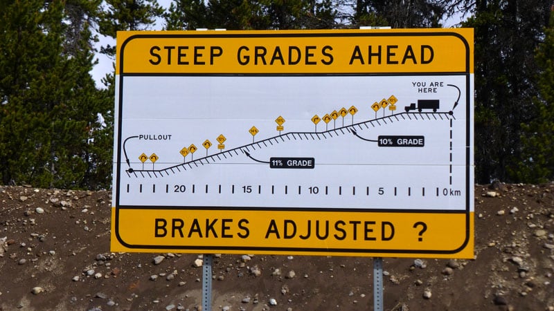
Don’t even think of reading this article if you’re chicken to take your rig off pavement. Just put your laptop, tablet or phone down and walk away. If you’re still here, check your spare, engage four-wheel drive low and proceed with serious caution.
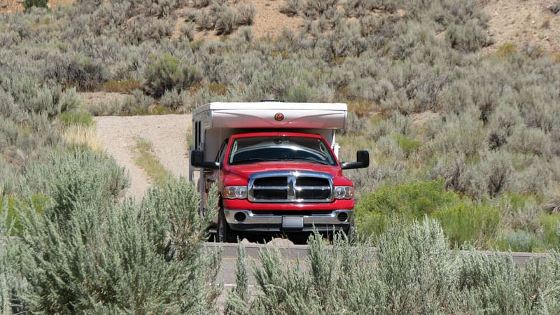
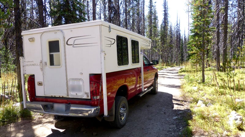
Don and Kris Hanley have camped 618-nights in their 2005 Ram 2500 and 2009 Hallmark Guanella pop-up truck camper. Along the way they have camped in 433 different camping locations and traveled through 16 states, 5 Canadian provinces and 2 territories.
More importantly, Don and Kris have tackled some of the most difficult backcountry roads in the western United States and Canada – all with their truck camper. We asked them to tell us about their experiences on these roads, and share their recommendations on what it takes to accomplish them.
Before we get to their harrowing list, we asked them a few questions about their truck camping background and what drives them to tackle these amazing – and often terrifying – roadways.
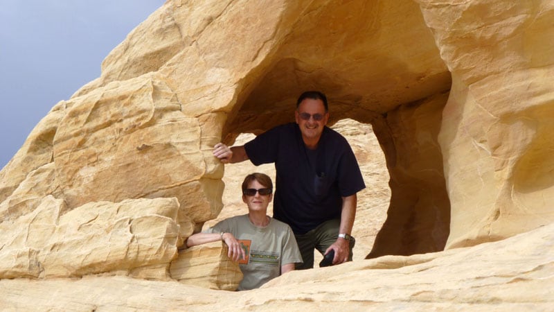
Above: Kris and Don Hanley
Thank you for sharing your truck camping experiences on some of the more challenging roads in the western United States and Canada. How did you learn to handle off-road conditions?
I’m a retired professional forester. I have traveled on a lot of backroads. Years ago I drove to Arizona on the western edge of the Grand Canyon. While this drive was a piece of cake for me, I would not have tackled that drive if not for my years of knowledge and experience driving poor quality roads.
I realize that different people have different standards of difficulty. With that in mind, I did my best to explain the specific challenges of each road and give folks an idea of what to expect.
As a side note, I want make it clear that we do not drive off-road. All of the roads we describe are poorly maintained public roads. We are not creating our own roads.
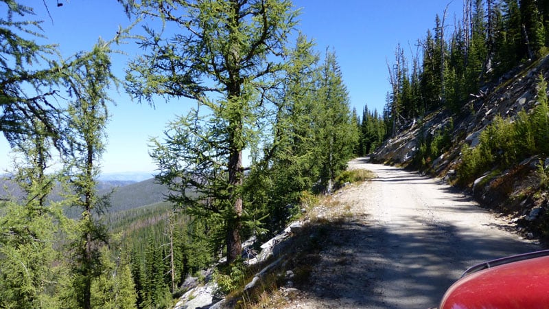
Above: Driving on the Magruder Corridor
That’s a very good point. Most of what we call off-road travel is actually poorly maintained public roads. How do you find these public roads?
We lived in Idaho and heard about the Magruder Corridor and Bergdorf Grade. We have always wanted to drive these roads. We had planned to do these drives a few times, but our plans were canceled by forest fires or road closures due to snow.
Above: The Charles M Russell Wildlife Area, Montana
The other way we find these roads is to look at Benchmark Maps, Backroads Mapbook and Google Maps. We will also contact the Forest Service or BLM in the local area. They have vehicle access maps of roads you are allowed to drive on.
If we find a road that looks interesting, we just go. We can go just about anywhere with our four-wheel drive Ram and Hallmark Guanella pop-up truck camper. There have been only a couple roads where we needed to turn around.
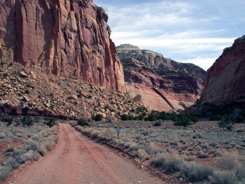
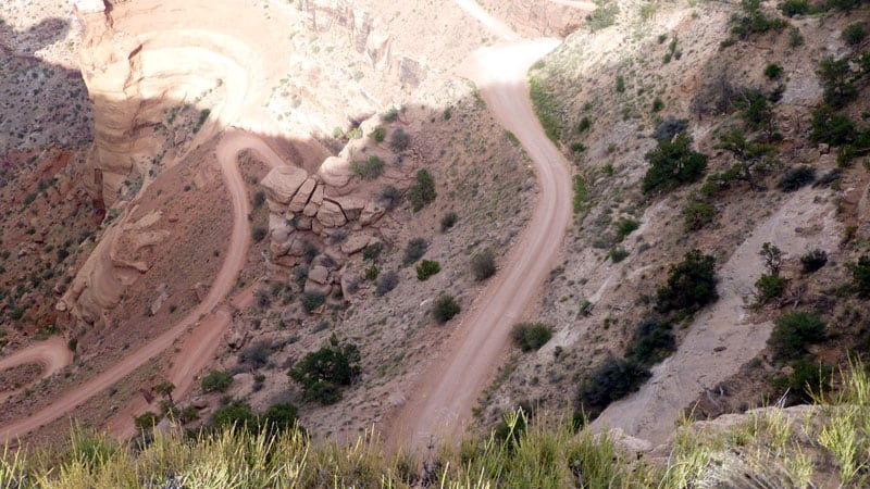
Above: Capitol Reef National Park, Utah
In all of your poorly maintained road travel, have you run into any trouble?
The only real damage has been scratches to our truck and camper. We have scratched our camper on vegetation, especially in the desert. The locals call them, “Mojave racing stripes”. There may be sage brush or cactus. A bigger camper would get hammered.
Considering where you’ve been, that’s amazing. How do you prepare for these adventures?
You have to be prepared and self-sufficient. That means that your vehicle is in excellent mechanical condition with good tires, a spare and you have the ability to change your spare. We also always carry a saw for downed trees, an axe, a bucket and a shovel. These are usually required for fire certain times of the year.
We also carry the proper tools to fix our vehicle should we have a minor breakdown. There is no cell service on most of the roads we travel. On the Magruder Corridor, if we had broken down, we would have waited until someone came along to help. They’ll help because they know you’re stuck, and they know it might be them who needs help from you next time.
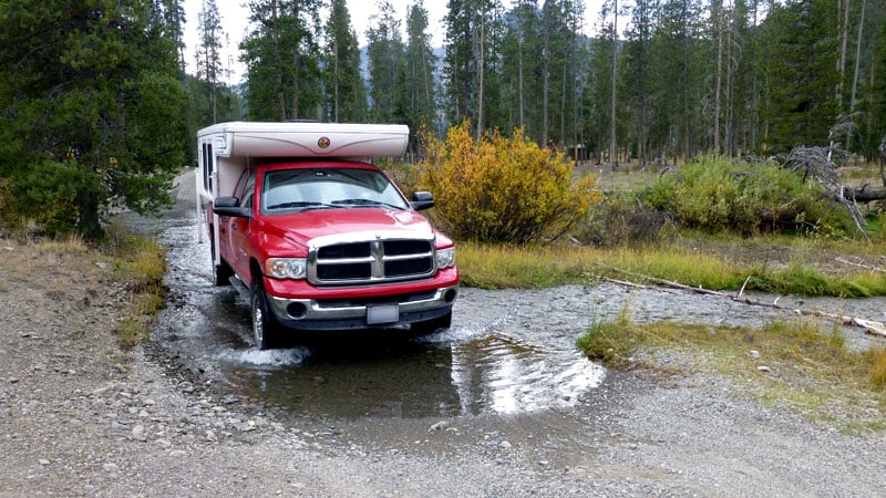
Above: Crossing the Salmon River in Central Idaho
Our Hallmark Guanella camper is 100-percent stocked when we go out so that we can survive a few days without needing anything. We purchased the Hallmark because it was well constructed throughout. We have camped over 620 nights and have been over thousands of miles of crummy roads and it is still structurally perfect.
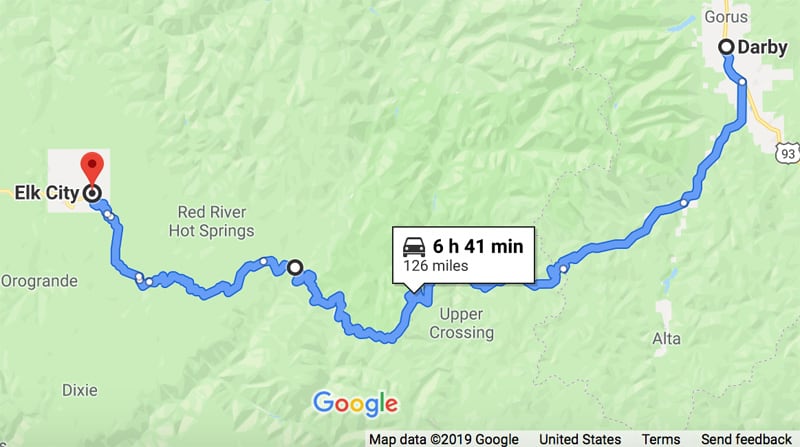
by Don and Kris Hanley
Difficulty: Extremely Difficult
Length: 126-miles total with 100-miles in backcountry
Location: Between Elk City, Idaho and Darby, Montana
Planning: https://www.fs.usda.gov/Internet/FSE_DOCUMENTS/stelprdb5143487.pdf
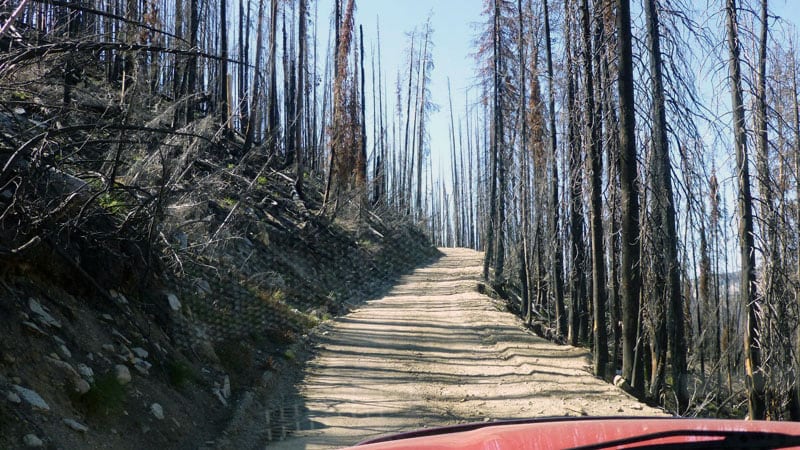
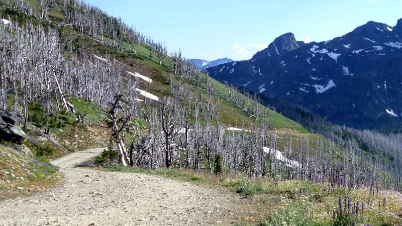
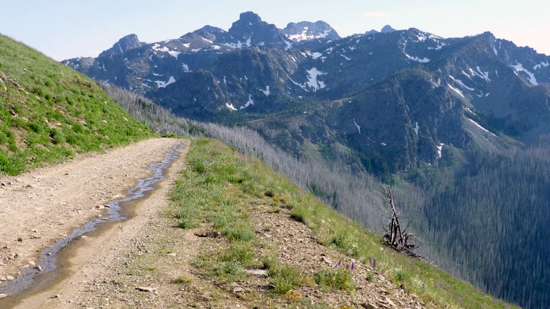
Description: For an off-road enthusiast, the Magruder Corridor is definitely 100-miles of joy. It is wedged between two wildernesses, and is a unique road in the national forest system because both sides of the road are official wilderness.
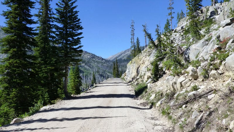
The Magruder Corridor is narrow and steep with rock outcrops that make it challenging. When I say outcrop, I am talking about the rocks sticking out from the cut-slope of road. These rocks can hit your camper. There are also embedded rocks in the road’s surface that you have to slowly drive over to preserve your tires.
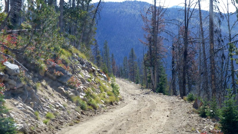
The pine, fir, and larch trees near the road’s edge, makes it a narrow drive. Due to the narrow and steep conditions, hard side truck campers would have difficulty traversing this road because of the increased width and height.
I rated the Magruder Corridor as extremely difficult because you need a skilled driver to navigate the forest, the steep narrow roads, the rocks jutting up in the road, and the drop-offs. Anyone with a fear of heights is not recommended for this drive. Pay attention to the many pointed rocks in the road. Four-wheel drive is advised for clearance to get over the rocks on the road’s surface and to deal with any rain or snow.
Keep in mind that this road was built in the 1930s and has never been improved.
Travel Tips: There were some pull-outs and junctions where you can pull over if you need a break. Otherwise the Magruder Corridor is a single-lane road.
In the pull-out areas you have room to pass another vehicle. You will encounter few of them throughout the 100-miles of backcountry. Once you get into Montana, there is a big pass with plenty of room. It also turns into a better forest service road.
We took two days to drive the Magruder Corrider. We camped at one of the unimproved campgrounds. During those two days we saw a pickup truck and a backcountry ranger. There were also two motorcycles and four wheelers. You are definitely on your own.
Out of all the roads on this list, the Magruder Corridor is probably most restrictive because of the high elevation. Snow and forest fires are possible.
It is critically important to plan your route by contacting the ranger stations ahead of time to ask about the conditions. I feel it’s mandatory. The rangers will tell you if there is an issue. If there is snow, they don’t plow. They just let the snow melt.
Above: Bitterroot National Forest along the Magruder Corridor
Camping: There are three or four free dispersed camping areas throughout the Magruder Corridor. They are located on the side of the road and have a dry pit toilet. You will easily see the pull-outs where you can camp. These are typically areas for hunters and trailheads.
Difficulty: Extremely Difficult
Length: 25-miles one-way from Imnaha to Hat Point Lookout, Oregon
Location: East of Enterprise Oregon in the Hells Canyon National Recreation Area
Planning: https://www.fs.usda.gov/recarea/wallowa-whitman/recarea/?recid=51929
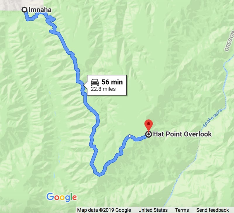
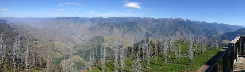
Description: Hat Point Road is located in the Hells Canyon Natural Area. You drive in and out on the same road with your main destination being Hat Point Lookout. As you drive to the lookout tower, you will climb to a high elevation.
There is a beautiful view from the top. Hells Canyon Gorge is the deepest gorge in North America. It’s very narrow and deep, so it’s spectacular.
Travel Tips: I strongly recommend that hard side campers do not go on this road because of the rock outcroppings that make it hard to navigate. Be aware that there may be 1000-foot drop-offs on one side of the road. People underestimate what they are getting into.
You have to know how to back up your rig. Someone is going to need to do it if you meet someone in the road. Backing up may be required for vehicles to pass.
Two-wheel drive vehicles with low gears should be okay in dry weather. If it’s been wet, a four-wheel drive vehicle is highly recommended.
It was a busy road. We were there on a beautiful summer afternoon and it was crowded with vehicles. There were a number of people who were unprepared with their vehicles and their ability to drive this road which meant that they got stuck or had flat tires.
We saw two vehicles with flat tires within the 25-miles. You don’t want to take a vehicle on a road like this with blow-up spares.
Camping: There was a campground at the top, but most people go up to see the view and then go home.
Difficulty: Extremely Difficult
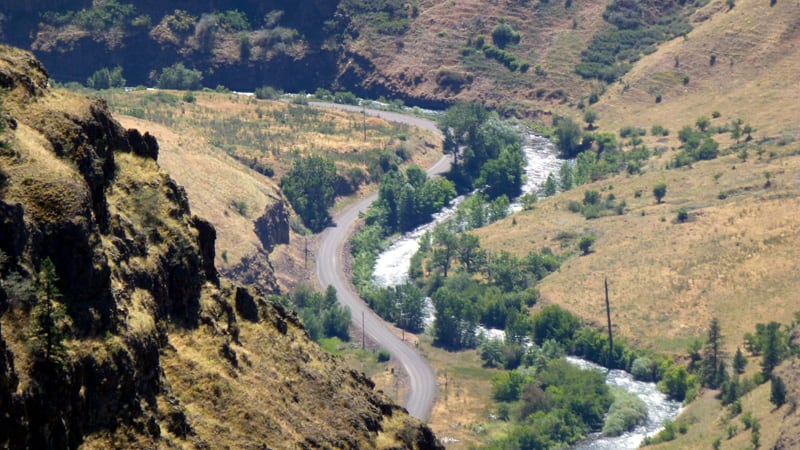
Length: 26-miles from French Creek on Salmon River to Bergdorf, Idaho
Location: Central Idaho, east of Riggins
Planning: https://www.fs.usda.gov/detail/payette/about-forest/offices
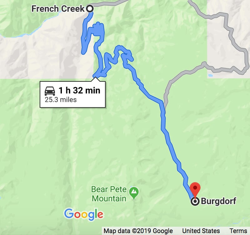
Description: Bergdorf Grade, even though it is only 26-miles long, it will take you an entire day to complete. There is a 4,000-foot difference in elevation from the Salmon River to the top.
This road typically opens in July because of heavy snows in Idaho.
Travel Tips: This is a pop-up camper only road because of the steep, narrow and sharp switchbacks. Some of the switchbacks were so tight that we had to back up to get around them. We couldn’t make the turn all at once and had to be in low-range four-wheel drive.
The surface is really rocky as you climb many thousands of feet from the Salmon River to Bergdorf. We were going about five or six-miles an hour. You have to get to the base of the grade which is quite a few miles across the Salmon River.
If a vehicle is coming down when you are going up, it could be tough to get around them. There are a lot of switchbacks so you have to be careful. When we were there, there was no traffic. Be aware that traffic can come in the opposite direction.
Camping: We did not camp here. However, you can camp on either side near the river. The ground is too steep to camp on the actual road.
Difficulty: Difficult
Length: 45-miles from Tendoy, Idaho to Clark Canyon Reservoir, Montana
Location: Crosses the Continental Divide between Idaho and Montana
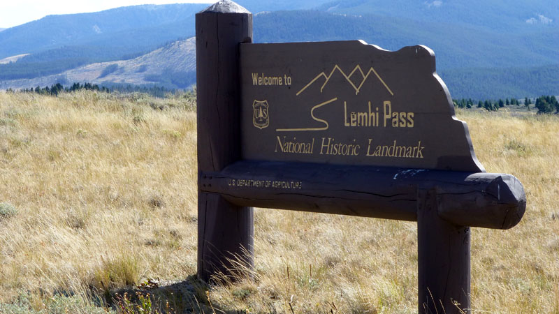
Planning: https://www.nps.gov/places/lemhi-pass-mt-id.htm
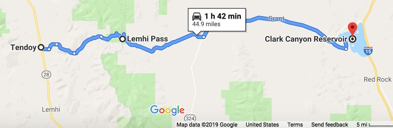
Description: This road is pronounced, “Lehm-hi”. It is in eastern Idaho in the Rocky Mountains. Lewis and Clark traversed this pass during their epic Corp of Discovery travels.
Lewis and Clark took different routes going east-west and this was one of them, so we wanted to see it. The Forest Service put historic markers down that you’ll see throughout the road.
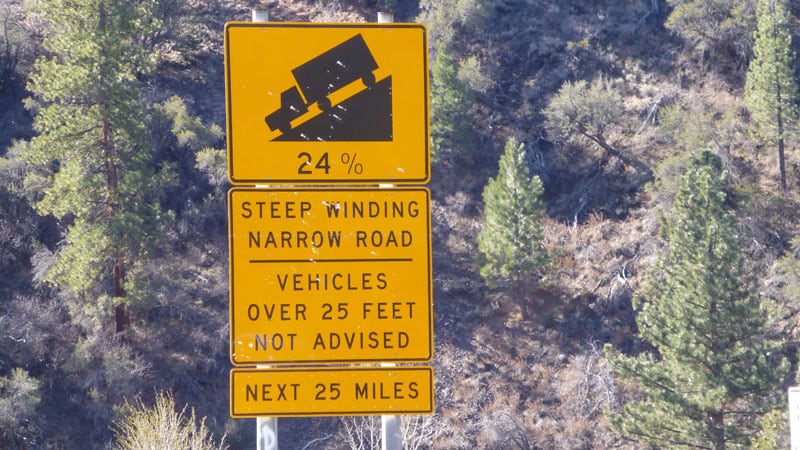
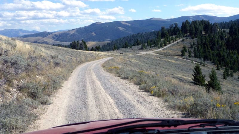
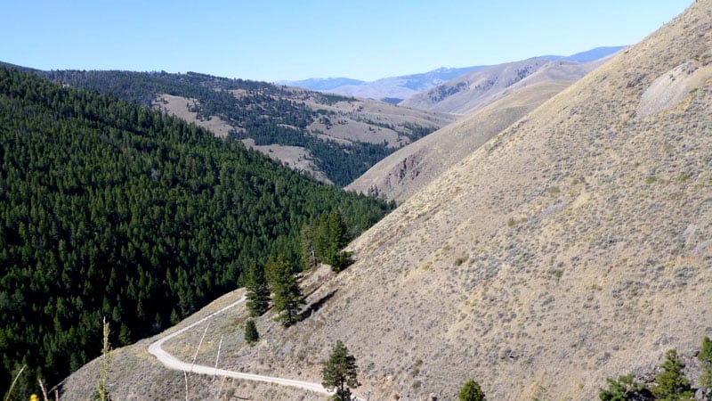
Travel Tips: Lemhi Pass is in a remote area. There are steep grades up and down as you go across the continental divide. It is not bad surface, nor is it very narrow. However, you must be aware that some grades on this road are up to 25-percent. Low-range four-wheel drive is recommended.
The advantage of a pop-up in this case is the lighter weight of the camper. We are not driving with the extra weight on the tires. If you have a heavier camper you would strain the tires going over rocks and there is more pressure going downhill on your vehicle. That’s why we like a lighter weight pop-up. We are not concerned going down these rocky roads.
There were places where we had to stand up and look past the grade to see how steep it was. Jeeps can do it easily but, with a camper on the back, it’s pushing it.
There are not many trees on Lemhi Pass, so it’s not a narrow road. We didn’t see anyone while we were on the road. We drove all 45-miles in one day.
Camping: We camped on one side or the other.
Difficulty: Not very difficult
Length: Approximately 200-miles from the British Columbia and Northwest Territory border north via Fort Liard to Fort Simpson
Location: Near Fort Liard, Northwest Territories, Canada east of Nahanni National Park
Planning: https://www.ehcanadatravel.com/northwest-territories/highways/liard.htm
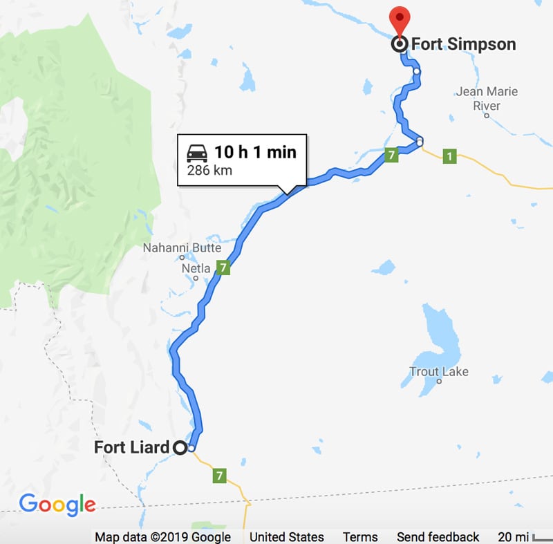
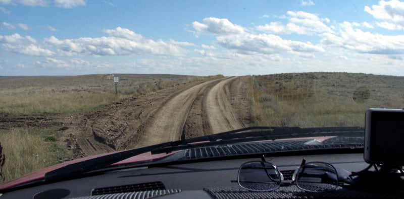
Description: Traveling from Fort Liard to Fort Simpson there are gravel roads. It gets flatter the further north you go. We traveled 1,200-miles/1,931-kilometers north of the US border. In terms of people and places, it is extremely remote and extremely desolate.
It’s much more hilly in British Columbia than the Northwest Territories. You have to be well prepared and self-sufficient. There are few roads in the Northwest Territories, so they keep them in good shape. The forest is pruned and thinned from the roadway a long ways because they want sunlight to melt the snow and ice.
When you get to towns, first nation people live there. There is nothing between villages making this a fun area to explore. You will see lots of black bears and magnificent wood buffalo.
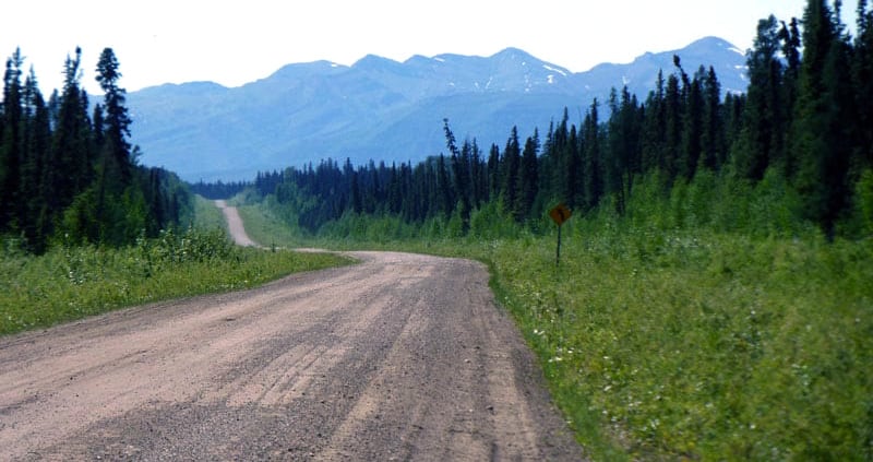
Travel Tips: The roads between Fort Liard and Fort Simpson are well-maintained gravel in two directions. You can use a two-wheel drive vehicle in dry weather. Your rig will get dirty!
A hard side camper could travel these roads, or even a trailer. When you get to the mountain passes, you will need to be more careful.
Camping: The provincial and territorial campgrounds are very nicely maintained. There aren’t too many of them and they are a ways apart. One we went to had laundry and restrooms. It was more like a state park campground. The ranger thanked us for being there!
Difficulty: Not very difficult in dry weather, more difficult in wet weather
Length: 73-miles one way to Bullfrog on Colorado River
Location: Grand Staircase National Monument and Glen Canyon National Recreation Area east of Escalante Utah between Boulder and Bullfrog, Utah. It is also accessible from Teasdale, Utah from the north.
Planning: https://www.nps.gov/glca/planyourvisit/driving-the-burr-trail.htm
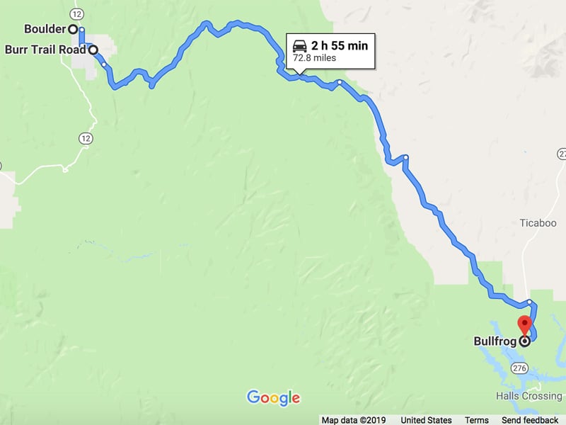
Description: The Burr Trail is in Utah’s Grand Staircase Escalante. It is in the high elevation forests of southern Utah. They are unique and scenic.
Travel Tips: You can take a hard side camper on the Burr Trail, but I would go in late May or early June to avoid thunderstorms and the rainy season.
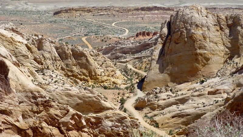
The Burr Trail is easy if it’s dry, but it’s impassable and hazardous if it’s wet. Four-wheel drive with deep lugged tires is highly recommended. I would not want to do this road in the sticky slippery mud. There are some steep grades and drop-offs. There are quite a few switchbacks, but they are wide and nicely done.
The road is wide enough to pass with care. There are pull-offs where people can rest or camp. It is remote because it is a long ways from town and there is no cell coverage.
There is more traffic here than most roads on this list. There are some nice hikes and overlooks.
Camping: You can camp throughout the Burr Trail area.
Difficulty: Not very difficult in dry weather, more difficult in wet weather
Length: 45-miles from Apache Junction to Roosevelt, Arizona
Location: East of Mesa, Arizona
Planning: http://www.americansouthwest.net/arizona/apache_trail/index.html
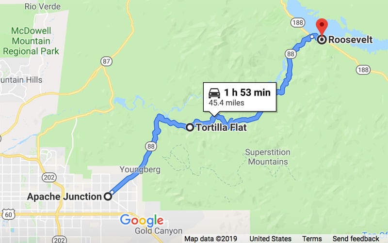
Description: The Apache Trail traverses the Superstition Mountains and Tonto National Forest. You will travel through a town, called Tortilla Flat, that has a really neat saloon. Inside there are dollar bills tacked to every square inch of it. It’s a nice place to wet your whistle while traversing the road.
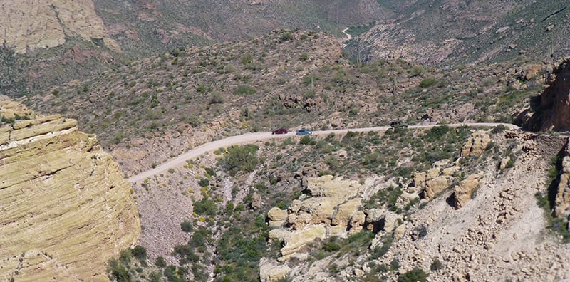
Travel Tips: With care, you can travel this road with a hard side. It was narrow in a few places. Be aware of the rock outcrops and drop-offs. It is steep, winding and is mostly unpaved, but there are pull-offs.
We had to back up a few times because people were going the other way, taking their half out of the middle. I can back up easily, so I it wasn’t an issue to get to a wide spot.
It is better to travel this road on the weekdays because on the weekends the locals like to drive it. Overall, it’s an easy road. Two-wheel drive vehicles are okay in dry weather. The Apache Trail is not as bad as Hat Point Lookout or the Magruder Corridor.
Camping: We drove through without camping.
Difficulty: Not very difficult in dry weather, more difficult in wet weather
Length: 18-kilometers/11.2-miles of gravel switchbacks over “the hill”
Location: Provincial Route BC-20 through Tweedsmuir South Provincial Park, approximately 200-miles west of Williams Lake, British Columbia
Planning: https://www.themilepost.com/highways/chilcotin-highway-bc-highway-20/
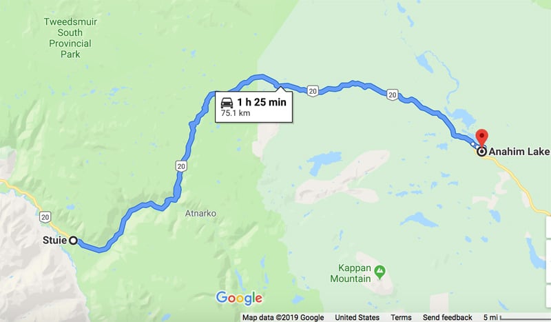
Description: The Chilcotin Highway goes from Williams Lake to Bella Coola, British Columbia. BC-20 is a 279-mile/450-kilometer highway that traverses east-west through central British Columbia.
We have generally found that grades in British Columbia are much steeper than in the USA, so you need to drive it with caution. Just like Washington, it’s wet west of the mountains and dry east of the mountains.
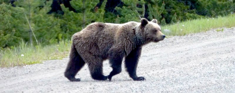
Travel Tips: BC-20 is the main east-west road, so we saw other vehicles. It would only be crowded when people are out fishing for salmon in mid-summer. That’s where the grizzly bears we saw were located.
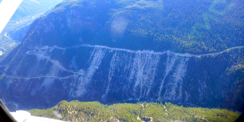
Above: Taken from a small plane, Chilcotin-Bella Coola Highway near Hickman Pass
The Hill is 18-kilometers/11.2-miles of a gravel road. It’s rutted, narrow and very steep. It is well-maintained. Heckman Pass is at an elevation of 5,000-feet. Going into the Bella Coola valley, it has grades of 12 to 18-percent.
Hard side campers could do the hill. You don’t need to back up because it’s wide, but it’s very remote. If you got into trouble you might be there for a few hours before you can get help.
Use four-wheel drive in low gears on the hill if it’s wet or snowy.
Above: Chilcotin-Bella Coola Highway, the pull-out at Heckman Pass
Camping: Campgrounds are along the route, along with grizzly bear habitats. The provincial parks are nice. There are very few people in that huge country, so there’s a lot of room to camp.
Difficulty: Not that difficult
Length: 48-miles on Cottonwood Road
Location: East of Bryce Canyon National Park proceed to the small community of Cannonville, Utah, then turn south on road 40 from the center of town.
Planning: https://www.blm.gov/programs/national-conservation-lands/utah/grand-staircase-escalante-national-monument
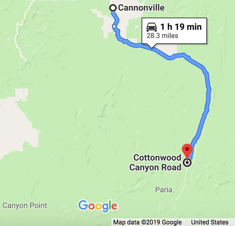
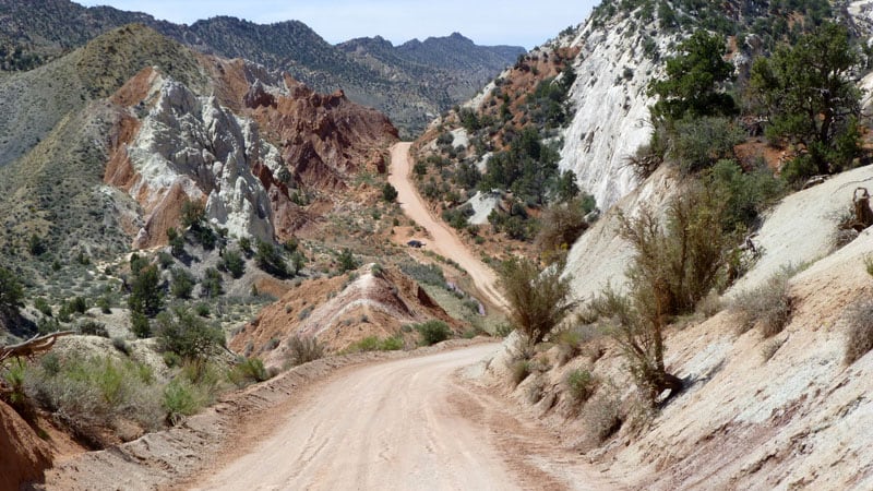
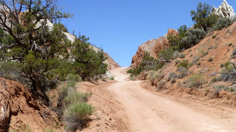
Description: Cottonwood Road, which is also known as road #40, goes south from Cannonville for 48-miles through Grand Staircase Escalante National Monument, terminating at Highway 89.
Travel Tips: This road is a dirt surface, so four-wheel drive is generally required when road surface is wet. The clay soils in this part of Utah are extremely slick. There are short and steep grades, but no intimidating drop-offs. It can be accomplished by a hard side camper with caution. Narrow and slow in places.
Be sure to take the side trip to Grosvenor Arch, which is very spectacular. Camera shots can be taken in abundance.
Camping: When we were there years ago, we could just pull off the main road and camp wherever there was an open area. It is always a good idea to inquire if dispersed camping is allowed.
Difficulty: Difficult
Length: 19-miles up and 19-miles back down
Location: Southwest of Riggins, Idaho in Hells Canyon National Recreation Area
Planning: https://www.fs.usda.gov/recarea/wallowa-whitman/recarea/?recid=51645
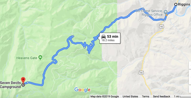
Description: Seven Devils Campground is a small campground well suited for small campers or tents. Start at the Forest Service Office on Highway 95, just south of Riggins. Turn west on to Seven Devils Road, NF517 (Squaw Creek Road), which is a short distance south of the Forest Service Office.
This road was gravel when we drove it and starts out easy. You will climb 5,500-feet in elevation for 19-miles from Riggins to the campground. A property loaded camper with excellent brakes and low gears is a must.
The country in this part of Idaho is steep with grasslands and forests that appear to go up to the sky. There are great views along this route.
Travel Tips: This is a poorly maintained gravel road at the upper end. You have to drive up and back. Four-wheel drive in low gear is recommended. There are steep grades and six to seven tight switchbacks near the end of this dead end road.
Riggins can often hit 100-degrees in the summer, but this campground, because of its elevation, is much cooler. You might even need to put on a light jacket.
Camping: Seven Devils Campground is at the summit. When we were there mosquitoes were in abundance due to the small lake nearby, but is well worth the visit.
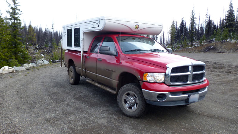
Kris and Don’s Rig
Truck: 2005 Ram 2500, diesel, crew cab, long bed, four-wheel drive
Camper: 2009 Hallmark Guanella
Tie-Downs/Turnbuckles: Happijac
Suspension: Firestone Air Bag Helper Springs on rear axle, aftermarket steering box brace
Gear: Toyo Open Country A/T LT265/70R17 tires, Ram 48RE automatic transmission, 3.73 differential