In their Land Rover and Northstar 700DL truck camper, Martin Dover and his wife, Jan, traveled from the United Kingdom to Nordkapp; the European equivalent of Alaska’s Prudhoe Bay. In total, they visited 13 countries and crossed 18 international borders. This is their story.

It’s often said that the journey is more important than the destination. This was certainly true for our trip last summer.
In our Land Rover Defender and Northstar 700DL, we traveled up through Scandinavia to Nordkapp; the most northerly point on mainland Europe. In many ways, Nordkapp is the European equivalent of Alaska’s Prudhoe Bay. Nordkapp turned out to be a windy, cold, and God forsaken place.
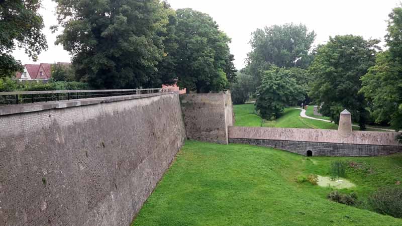
Above: The Bergues walled town, France
Our adventure started in the south of England where we drove to the Dover ferry terminal. The Channel Tunnel, our preferred crossing method, was unfortunately fully booked.
Upon arrival in France, we headed to a campground in Bergues, a lovely old walled town south of Dunkirk.
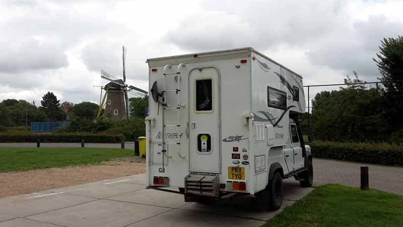
Above: Campsite in Domberg, Netherlands
The following morning we headed north along the coastline first through Belgium and the Netherlands. We used the Westerchelde toll tunnel to avoid passing through Antwerp congestion and camped at the beach in Domburg.
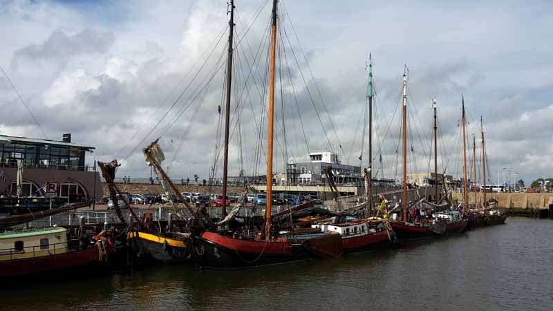
Above: Historic Harlingen in the Netherlands
The next day we skirted Rotterdam and Amsterdam and crossed the Ijsselmeer causeway. Our evening stop was the lovely historic port of Harlingen.
We pulled in for lunch the following day in Lauwersmeer National Park. There we enjoyed a lovely walk around the lake toward a marina complex.
Our satellite navigation was giving us a few issues so we stopped in Groningen at a Euronics store and bought a new large screen Garmin DriveSmart GPS. Then we crossed the border into Germany and spent the following night in a campground in Sande south of Wilhelmshaven.
We had hoped for views of the sea but were thwarted by a flood defense barrier covered in sheep. Anya, our English springer spaniel, had to stay on the lead as she can’t always be trusted not to give chase.
The following day we crossed the Elbe River near Hamburg and found a car park with an adjacent restaurant in Kollmar. Up to that point, we had traveled through countries we had previously visited with the camper.
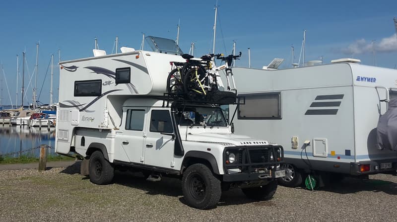
Above: Staying overnight at the Aarosund marina in Denmark
The following morning we crossed into Denmark and made our way to a campground in Aarosund on the Baltic coast overlooking the island of Aro.
As we were somewhere new, we had a relatively short traveling day and did some sight-seeing before ending up in a dedicated motorhome parking area of a supermarket car park in Aarup.
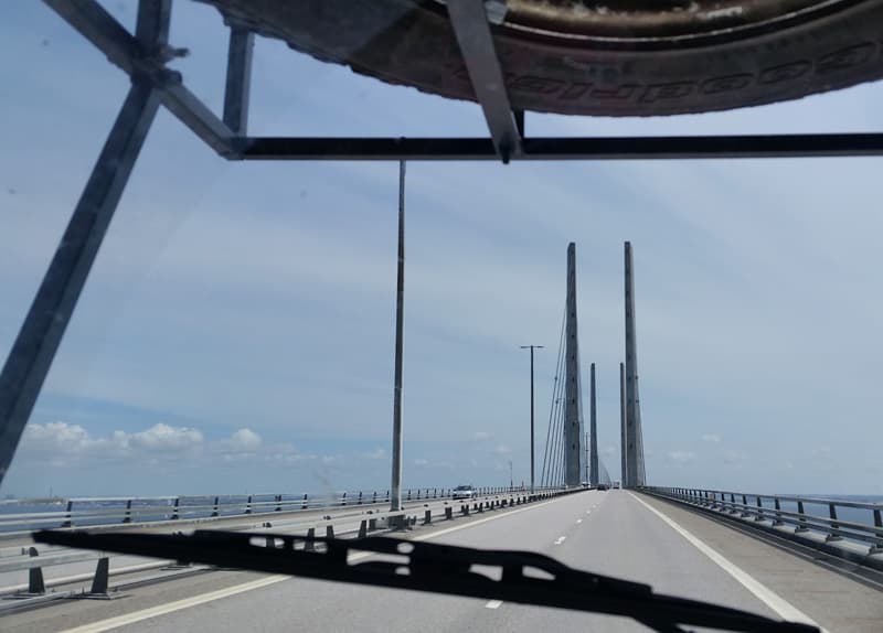
Above: The Oresund Bridge that goes from Denmark to Sweden
We achieved one of our trip objectives when we crossed into Sweden via the Oresund Bridge. “The Bridge” between Copenhagen and Malmo has been made famous by the Scandinavian television dramas of the same name.
That night we stayed in a campground on a beach to the south. We had a superb view of the bridge and a lovely cycle ride around the area.
The next day we initially headed northwest towards Norway but there was a poor weather forecast for the west coast. We, therefore, decided to stay in Sweden and head north on the E4 alongside the Baltic.
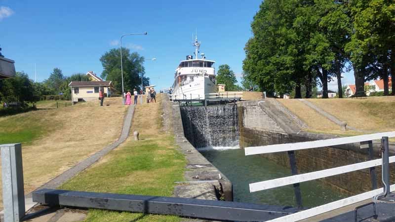
Above: Gota Canal in Berg, Sweden
Our stop for the night was in the town of Berg on the Gota Canal. The canal was designed by British canal engineer Thomas Telford in the early 1800s. There are some impressive locks connecting lakes and rivers which created a complex route for large vessels between Gothenburg and Stockholm.
Once we were north of Stockholm, we really started clocking up the miles. Traveling on the main E4 highway we were passing through rather boring forests and only stopping for meals and dog walks.
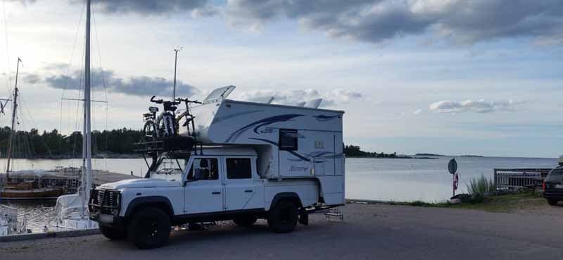
Above: A marina in Vavd, Sweden
During this time I was keen to make our overnight stops as interesting as possible. Jan navigated us to a harbor campground at the correct distance on a headland near Vavd. There were nature trails for dog walking, so it was ideal!
Re-entering the E4 at Gavle, we pressed on. Just north of Harnosand, we turned off the main road onto an interesting unsealed gravel track.
After several miles we rejoined the tarmac and went to a campground near the village of Omne for the night where we parked amongst other campers near a lake. Again we had really nice walks in the woods around the lake.
By now we were noticing that the evenings were getting significantly lighter. Even at 11:00pm, it wasn’t really getting dark.
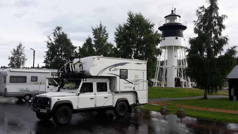
Above: Javre campsite and lighthouse, Sweden
The next day we got back on the E4 heading for our next overnight at Javre. The large campground was by a small harbor with an interesting lighthouse. There were some nice coastal walks through the woods.
After a few more miles on the E4, we turned away from the Baltic and onto the E10 towards Norway. The terrain was, however, unchanged with lots more trees.
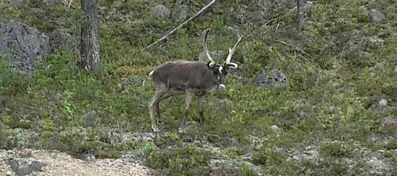
Above: Reindeer on the side of the road
After many miles, we came to a roadside sign that showed that we were crossing the Arctic Circle. A few miles further we entered Lapland and shortly after that we saw our first group of reindeer at the side of the road.
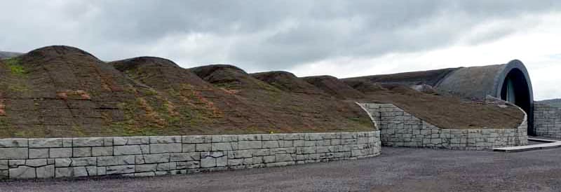
Above: An ice hotel in Sweden
We stopped that night at a small campground near Kiruna at Jukkasjarvi. The community is famous for being the location of the Ice Hotel offering guests a freezing experience during the winter months. When the snow and ice melt, however, the hotel doesn’t look quite so impressive!
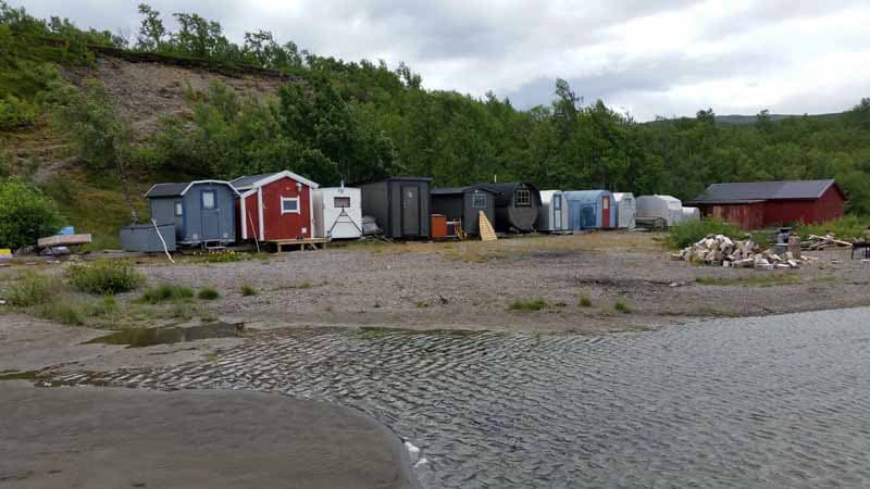
Above: Fishing Huts in Tornetrask Lake, Sweden
Back on the E10, we eventually came to a large lake called Tornetrask. We stopped for coffee and Anya and I went for a walk along the edge of the lake.
On our walk we found some curious huts on sledge runners. In the winter, these huts are dragged out onto the frozen lake by a snowmobile and used as shelters by local fishermen who cut holes in the ice for their lines.
After a few more miles the E10 turned away from Tornetrask lake and started to climb. Eventually we reached the Norwegian border at Riksgransen and, almost immediately, the bland landscapes were replaced with more interesting rocky visas.
We descended down to Narvik for lunch and refueled our propane tank. We use propane for cooking and to power the refrigerator. We then backtracked and headed north to Nordkjosbotn for an overnight stop.
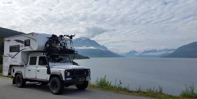
Above: Lyngenfjord, Norway
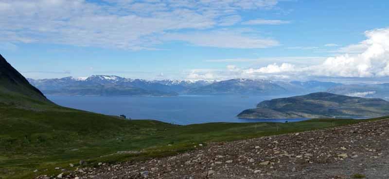
Above: Kvaenagenfjord, Norway
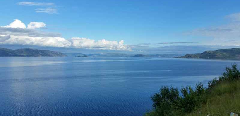
Above: Scenery overload in Altafjord, Norway
The following day we suffered scenery overload as we wound our way along the coast and around fjords. It was a truly magical drive to Alta at the head of Altafjord.
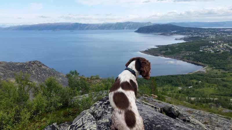
Above: Anja in Alta, Norway
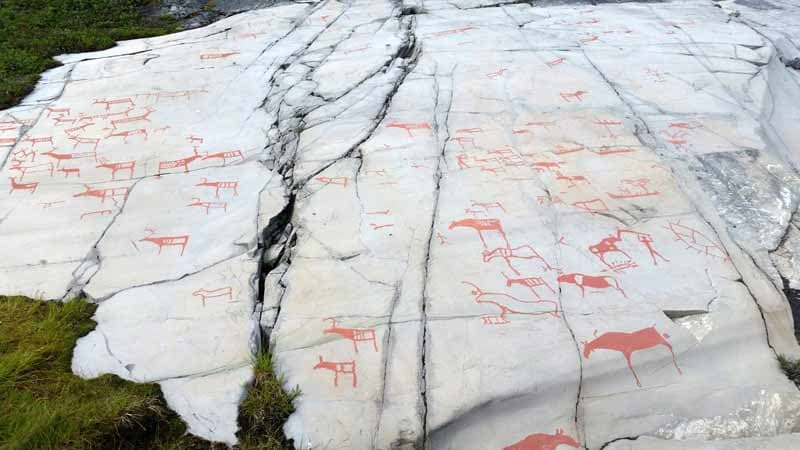
Above: Alta Rock Paintings, Norway
Our motorhome parking app showed that we could park overnight in the museum car park where there were some impressive ancient rock paintings. There were also some awesome hiking trails both along the fjord and up adjacent hills.
The next day we traveled to Nordkapp. The route started from almost sea level, but the road quickly rose onto a barren treeless plateau punctuated by small Sami camps.
At the Sami camps, the people were selling trinkets and reindeer goods from their herds. This made me rather uneasy as their previous simple lives of trading goods had been swept away by commercialism and the need for hard currency.
Their camps were often scruffy old caravans and shacks; not the romantic nomadic tents we see on television programs about the Sami tribes.
Things got much more interesting as we descended off the plateau towards the Arctic Coast at Olderfjord and then turned left with Nordkapp at last on the sign posts. It felt like we were nearly there but, in reality, there were still two hours and 80 miles to travel to our destination.
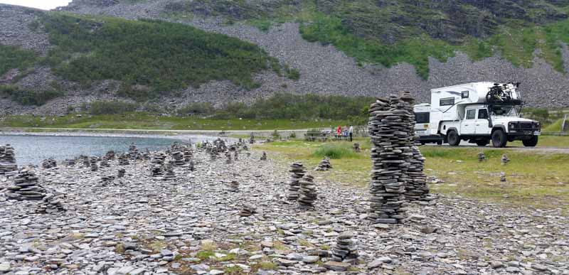
Photo: Cairns on the road to Nordkapp
The road to Nordkapp was only fully completed in 1999 and was a major feat of engineering. Much of it hugs the coastline with lovely views, but major works were needed elsewhere.
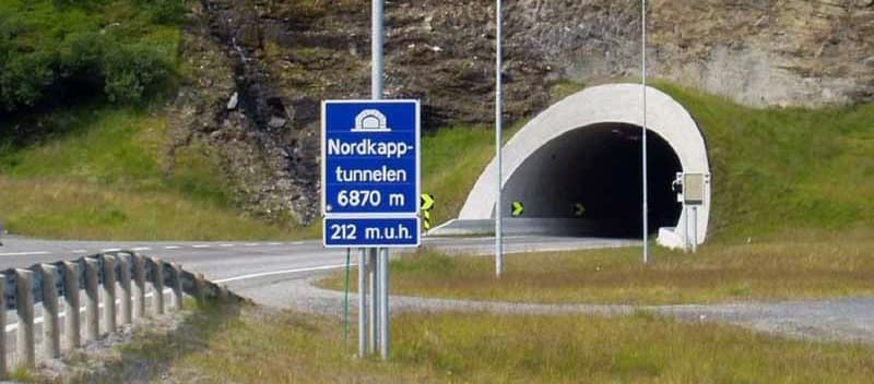
Photo: Nordkapp tunnel, third largest undersea tunnel in Europe
One tunnel replaced an arduous mountain track and a ferry crossing as it cut through the mountain and then under a fjord off the Arctic Ocean. It’s the third longest under sea tunnel in Europe.
The last town on the route is Honningsvag where you can buy fuel and provisions. This is also where the cruise ships dock before their passengers are bused the final 23 miles for the Nordkapp experience.
This last leg between Honningsvag and Nordkapp was the only place we actually saw any large herds of reindeer majestically roaming the plains.
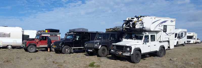
Photo: Land Rover Defender campers at Nordkapp
As we approached the huge car park at Nordkapp, we stopped at the toll booth and paid our £10 parking fee and £25 per head entrance fee. Considering the investment in the area, this seemed a really good value. We parked up next to three other Land Rover Defender campers. It’s funny how we always seem to congregate together.
When we got out of the cab it was blowing a full gale and despite it being about eleven degrees Celcius, the windchill made it feel sub-zero. For the first time since leaving the UK, we had to put on coats to explore the wild 1,000 foot high headland at the northern tip of Europe.
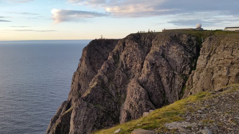
Above: The beautiful Nordkapp cliffs
We put Anya back in the camper while we looked around the impressive visitor center with coffee shops, a restaurant, gift shop, post office and a couple of audio-visual attractions.
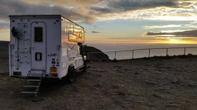
Photo 16 – Nordkapp sunset
As we were to spend the night in the carpark, I repositioned the camper to reduce wind buffeting. No matter how I parked it wasn’t going to be a quiet night.
After feeding Anya, we went back into the visitor center for dinner in the restaurant where I had, appropriately, reindeer stew. Then it was back to the camper to wait for midnight.
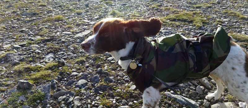
Above: It was quite windy in Nordkapp
At midnight, I ventured out into the wild conditions with Anya to take photos in almost full daylight. It’s true that I could have easily read a newspaper but, with the wind, it would have been difficult to keep the pages from blowing away!
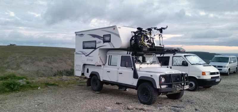
Above: Midnight at Nordkapp still has some daylight
Although everywhere north of the Arctic Circle is classified as the “Land of the Midnight Sun”, our visit was midway between the Summer Solstice and Autumnal Equinox. That meant that even as far north as Nordkapp (71o 10.3′ N) there was a sunset at 10:00pm and a sunrise at 2:00am but it stayed twilight between these times. It must be even more incredible when the sun doesn’t set at all, which we missed by only about five days.
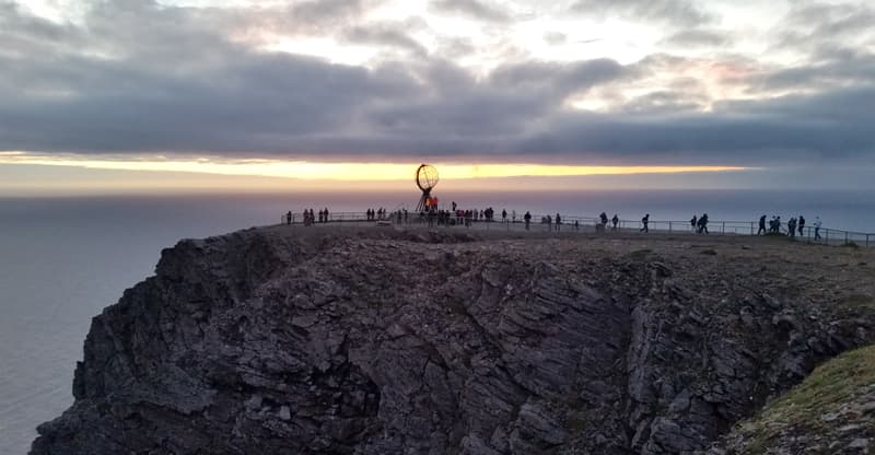
Above: Midnight in Nordkapp
It had been a very long drive in the Land Rover, but it would have been much harder for the large number of motor bikes that had also made the trip from all over Europe.
These motorized forms of transport, however, had it very easy compared to the pushbikers, some of whom had made a three month journey all the way from the southern tip of Spain.
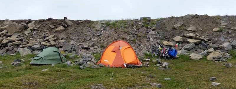
Above: Pushbiker tents in Nordkapp
Due to the remote location, the pushbike riders had no option but to stay at Nordkapp for the night. They had to use rocks to weigh down their tent flysheets to stop them from blowing away.
After our wind buffeted night, Jan couldn’t wait to leave this barren place and head south to less exposed terrain. Our trip south from Nordkapp was to be down the eastern side of the Baltic.
We had originally planned to enter Russia and visit St. Petersburg and Moscow, but visa issues, and the requirement for a special dog passport in Russian for Anya, made it just too much of a hassle.
We initially retraced our steps for 80 miles to Olderfjord and then followed the Arctic Ocean for a further 40 miles before turning south. There we crossed into our eighth country at Karigasniemi to head down through Finland. After crossing the border we filled up with diesel at a price far cheaper than it had been in expensive Norway.
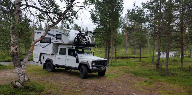
Above: Ivalo wildcamp in Finland
The terrain was initially very similar to Sweden but, after our first night south of Ivalo, it got worse! Not only were there the unending trees, but the roads were dead straight for miles. Then there would be a bend and then another really long straight.
Views to each side of the road were limited and you really couldn’t see the woods for the trees.

Above: Arctic Circle, Santa Claus World
When we crossed back over the Arctic Circle near Rovaniemi there was a theme park called Santa Claus World. Sadly this was the most interesting thing we’d seen for many miles.
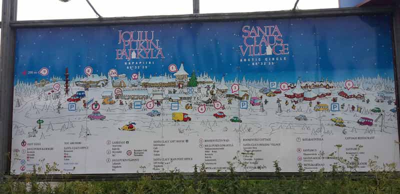
Above: Santa Claus Village Sign
We arrived back on the Baltic coast and spent our next night at a campsite on an island at Li north of Oulu. Then it was more of the same, mile after mile of trees as we headed down to our next campsite near Korpilahti at the side of a lake.
The next day we pressed on again to Helsinki where I arranged a fast ferry crossing to Tallinn in Estonia.
The ship was new for the 2017 season and called the Megastar. She was well named as it was the quietest, smoothest and fastest (at 27 knots) conventional ferry I’ve ever been on. It was powered by Liquid Natural Gas, and it was a speedy two-hour crossing to Tallinn. Jan also liked the ship which had the largest and best laid out retail shop we’ve ever seen on a ferry.
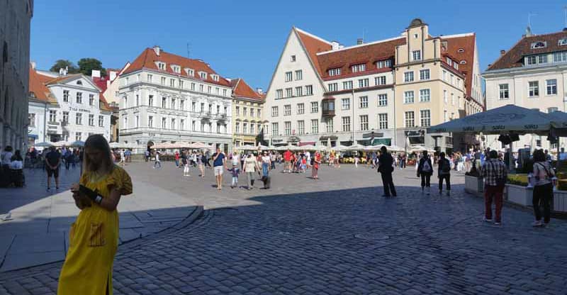
Above: The capital city of Estonia is Tallinn
After leaving the ferry we headed into Tallinn, the capital city of Estonia, and found a 24 hour secure car park for 12 Euros alongside the cities ancient walls.
Tallinn was a real surprise; beautiful architecture, plentiful restaurants, and a real tourist hotspot. We walked the walls with Anya before finding a nice place for dinner and heading back to the camper for the night.
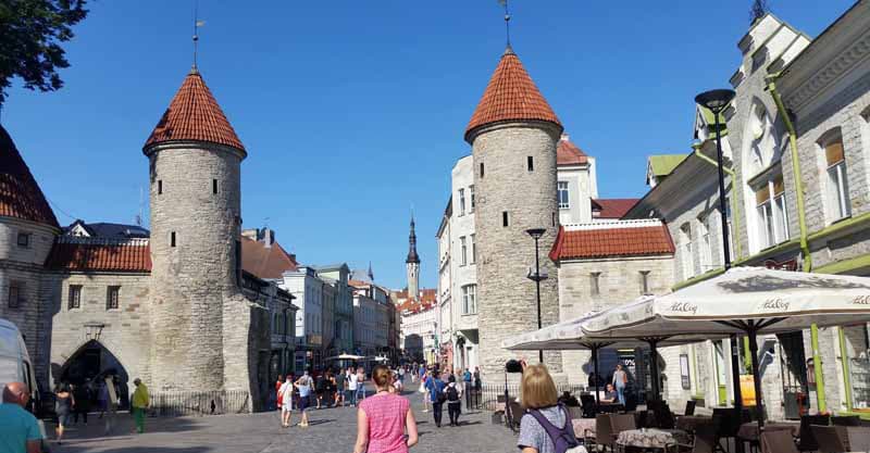
Above: Walking around Tallinn, Estonia
The next morning we went back into the town for another walk around and then headed 60 miles to the seaside resort town of Haapsalu on the west coast.
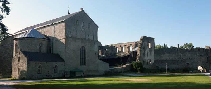
Above: Haapsalu Castle, Estonia
There was a huge railway museum there with massive Russian built engines, but our focus was on walking around the coastline and town, and also exploring the interesting castle. Again the architecture surprised us as there were both traditional timber-built houses and very modern contemporary properties all along the coastline.
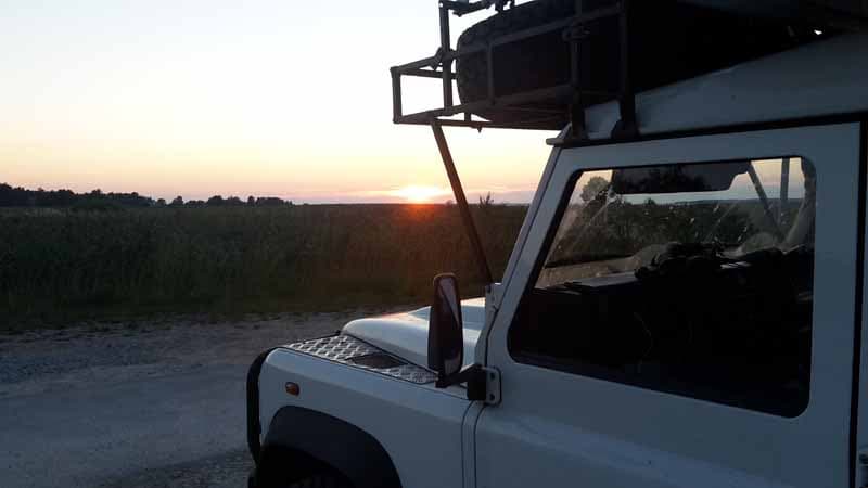
Above: Haapsalu sunset, Estonia
The next day we headed south to Virtsu and found an interesting track. The track terminated at an old lighthouse where we stopped for lunch.
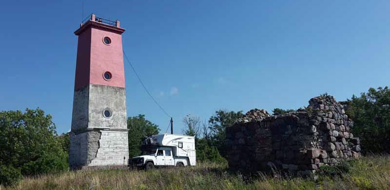
Above: Virtsu lighthouse
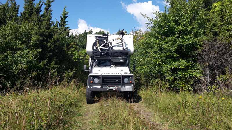
Above: Off-roading in Virtsu, Estonia
We then headed to the town of Parnu to a campground located next to the harbor. We ate at the yacht club.
It was very interesting looking at an ice yacht which they race in winter when the river freezes over. That night we had an amazing storm with high winds and rain, but also a most stunning sunset.
We left Parnu and headed east to the winter resort of Otepaa for lunch. There we had a lovely walk around the Puhajarv lake.
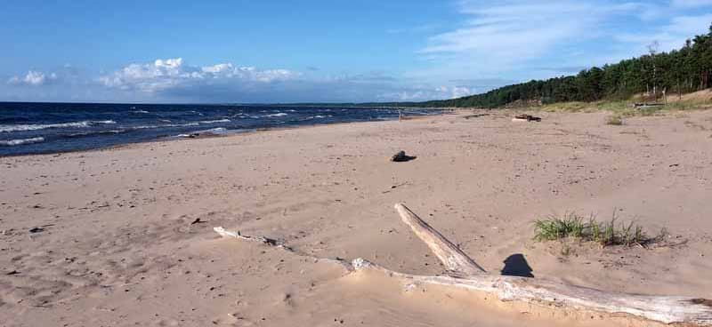
Above: Saulkrasti beach, Latvia
Then we traveled south again crossing the border into Latvia. First we visited the beach resort of Saulkrasti where, unfortunately, they had suffered a lot of damage in the storm the previous evening.
The beach at Sailkrasti could have been on a Caribbean island. It was just perfect! From Sailkrasti we moved on further south to a campsite at a marina in Riga which is Latvia’s capital city.
The next day we crossed into Lithuania where we saw our first British registered car for seven days, and only our third in the last 14 days. There certainly were not many Brits venturing this far north in their own vehicles. We stopped for the night at a motorhome campsite in Kaunas which allowed us to do laundry and other domestic tasks.
The following day we made a detour from the direct route turning onto the E7 at Marijampole towards the Russian exclave of Kaliningrad. In Kybartai we turned south off the E7 onto the 186 which runs roughly parallel to the border. At one point the border is less than 100 feet from the road.
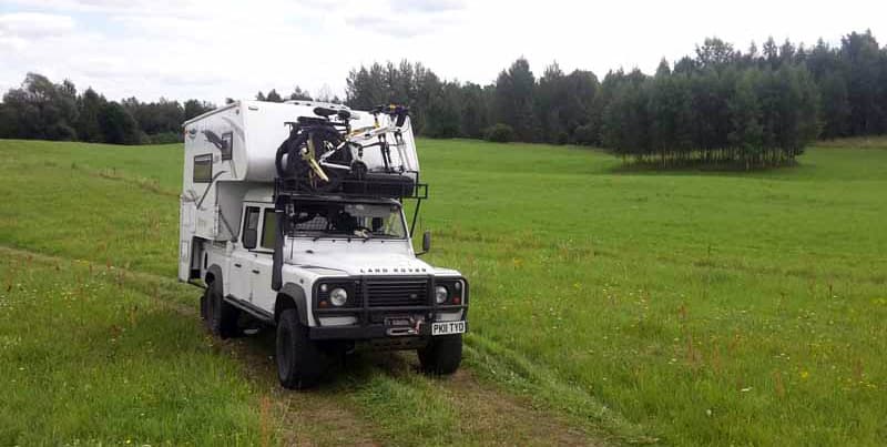
Above: Off-roading in Lithuania
We stopped for lunch in a national park car park. While Jan prepared lunch, Anya and I did some exploring. I won’t admit to another country being visited!
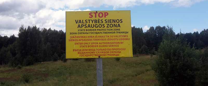
Above: A sign on the Russian border
We returned to the main road and soon crossed the border into Poland. We stopped for the night in a quiet car park near a river just outside the town of Lomza. There was a lovely walk along the river side for Anya to stretch her legs.
We had intended to visit Warsaw, but the traffic in the area was horrendous and we moved just two miles in one hour on the main route into town. We, therefore, accessed the ring road and stopped for lunch in a service station before pressing on towards Wroclaw.
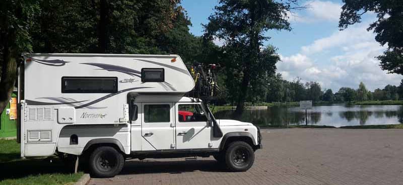
Above: Olesnica wild camp, Poland
We stopped for the night in the town of Olesnica where we found a nice park with ducks and lake, which resulted in one very wet dog!
The next day we revisited an area we had last been to 15 years before. We took the back roads through beautiful scenery along the Poland and Czech Republic border to the town of Liberec in the Czech Republic.
Our goal was Hotel Jested where we had stayed all those years ago. It is the most amazing place situated at the very top of a pointy mountain peak with the access road literally spiraling up the peak.
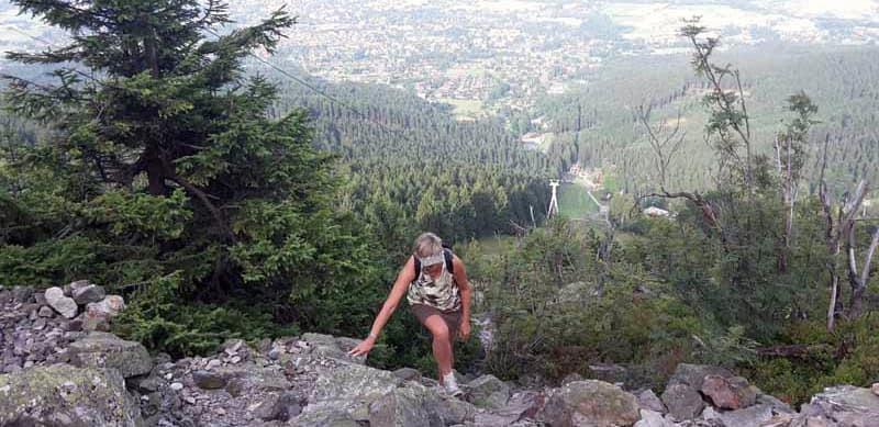
Above: Jan climbing Jested Mountain
After climbing up to the hotel via a steep path, we descended the access road again to search for somewhere we could stop for the night. We found a lovely spot in a car park on the slopes of Jested mountain. In the evening we returned to the top for a meal in the hotel restaurant.
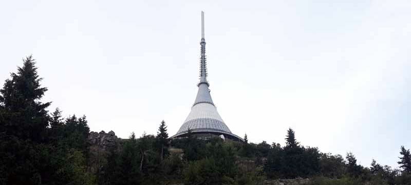
Above: The tip of Hotel Jested
The next morning, after some retail therapy in the Liberec shopping mall, we again avoided the main roads and wound our way towards historic Dresden, Germany. Roadworks near Decin revealed a real treat as the diversion route went past the amazing sandstone rock formations near Tisa.
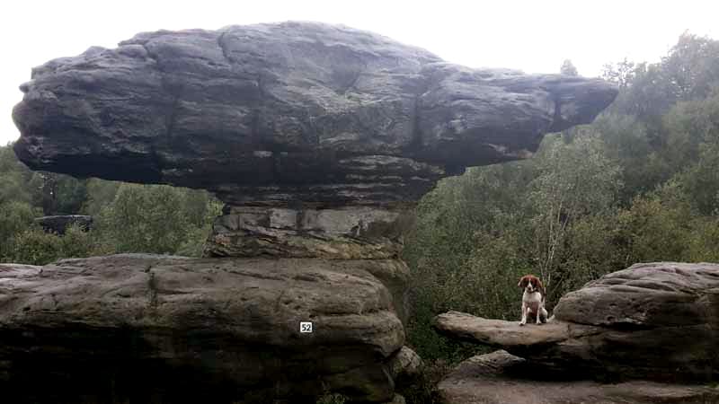
Above: Sandstone rock formations near Tisa
As we neared the German border, we went through the tacky town of Petrovice where multiple outlets were selling cheap consumer goods and bottled water. We stopped that night at a campsite in Bad Gottleuba.
We really wanted to go into Dresden for a look around the historic town. We knew parking may be a problem for our big rig, especially as it was during a weekend. I put the tourist information office into the navigation and followed the route shown into the city.
We passed a surface car park but we were not allowed in as it was reserved for market traders. Most other car parks we passed were underground with a height limit of 2.1 meters (6.88 feet). We kept on following the navigation into the old town along what appeared to be pedestrianized streets with many people milling around.
I realized we were actually driving past many of the tourist sights like the Frauenkirche that we wanted to see. There was still the odd other vehicle around, but we felt rather out of place among all the walking tour groups.
I eventually decided I’d better turn around and retrace our steps, so did a three point turn next to the Furstenzug porcelain mosaic. Many people were taking photographs of our rig as we passed through them – which was quite funny.
Leaving Dresden, we stayed on the autobahn for a while before turning onto secondary roads. Our next campsite was in a car park on the outskirts of Saalfeld. Again we had great dog-walking straight from our door and the lovely town was just a ten minute hike away.
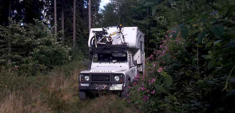
Above: Off-roading in Germany
The next day we almost managed to avoid the autobahns altogether as we headed further west and explored some off road routes.
Our research had located a campground at Hilchenbach near a large reservoir. The stop itself wasn’t that impressive as it was in a car park behind a sports center but it was nice and quiet as we were the only vehicle there.
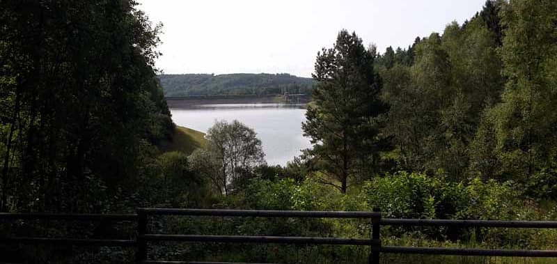
Above: The Hilchenbach reservoir
The next morning we drove up to the reservoir and had a nice four mile walk around the tarmac perimeter road. Unfortunately our route that day was almost entirely on the autobahns as we traveled past Cologne towards Brussels to meet up with friends.
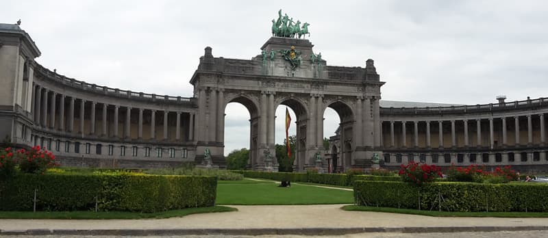
Above: Triumphal Arch in Brussels
To permit Anya to be repatriated into the UK, she has to visit a vet a few days before she arrives back on British soil for a health check. This we did in Brussels before having lunch with our friends and setting off back into France in preparation for the last leg home.
We stopped for the night back in Bergues where we had spent our first night on mainland Europe almost five weeks before. We had, therefore, completed our circumnavigation of the Baltic. In reality, we still had about 250 miles to go before we arrived home.
The next morning we had the short trip to the Calais end of the Channel Tunnel and, as usual, an easy run on the shuttle train under the English Channel. We drove along the south coast stopping near Brighton for afternoon tea and arrived home at 8:00pm.
In five weeks we visited 13 different countries, crossed 18 international borders, travelled 6,553 miles averaging 24.5 miles per gallon. It was a very long and successful trip! The eastern European countries that we’d visited had been a very pleasant surprise and we will definitely be heading that way again.
We saw surprisingly few truck campers on this trip and most of those we did see were hard side pop-tops with German registration plates. In the car park at Nordkapp there were loads of normal motorhomes, but just one other truck camper; a Swiss Toyota Hilux with a non-demountable camper unit.
Our truck camper performed faultlessly as usual and certainly makes a very comfortable home from home. Despite only having a 2.4 liter diesel engine, the Defender’s 160bhp is adequate for the Northstar 700DL (European spec) even when the camper is fully loaded and there are big hills to climb – there were quite a few on this trip!
Check out more stories from around the world in our World Travel section.


