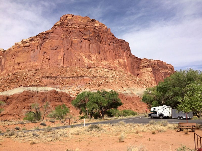
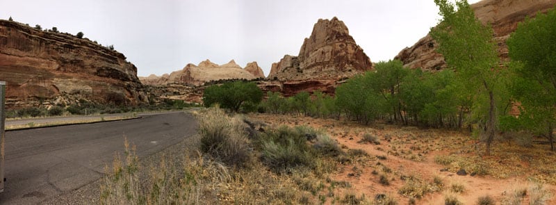
Capitol Reef National Park is known for its scenic drives and sandstone rock formations, pillars, arches and domes. But that’s evidently not why our readers go. It’s all about the pies.
Never before have we needed to ask for less pies and more destinations and camping information. And yet, submission after submission, we got pies, pies, sticky buns, breads, and more pies. Pies!
What exactly are you all doing at Capitol Reef National Park? There are stunning red rock formations, breath taking vistas, spectacular trails and incredible history – and all you want to talk about are the pies?
Maybe we should just change our name to Pastry Camper Magazine. The sad thing is, I can literally hear you thinking, “Oh, that would be good.”
Next week, “Pumpkin Pies In Pinnacles National Park”. Now that I wrote it, I’m starting to that’s not such a bad idea. Now look what you’ve done!
What follows are Capitol Reef National Park trail experiences, camping recommendations and – yes – culinary suggestions from a baker’s dozen of fresh fellow truck campers. The photography alone will have you adding to your bucket lists. All I know is now Angela and I need to go back, for the pies.
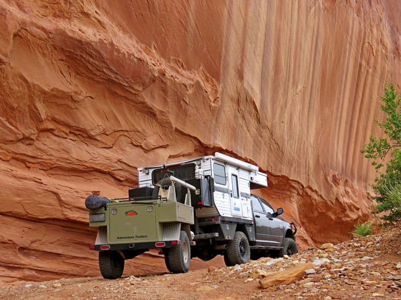
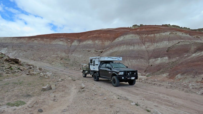
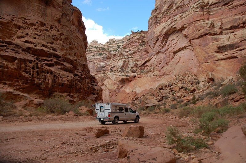
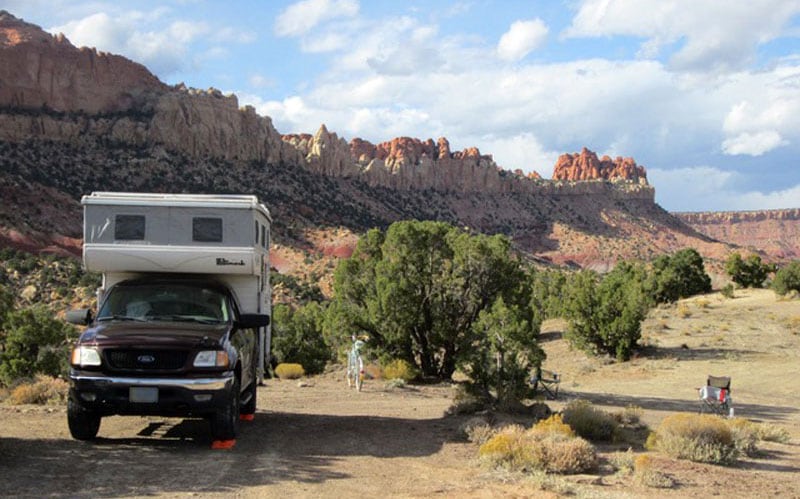
Gary and Laurii Gadwa
2012 Ford F350
2010 Eagle Cap 950
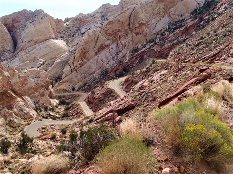
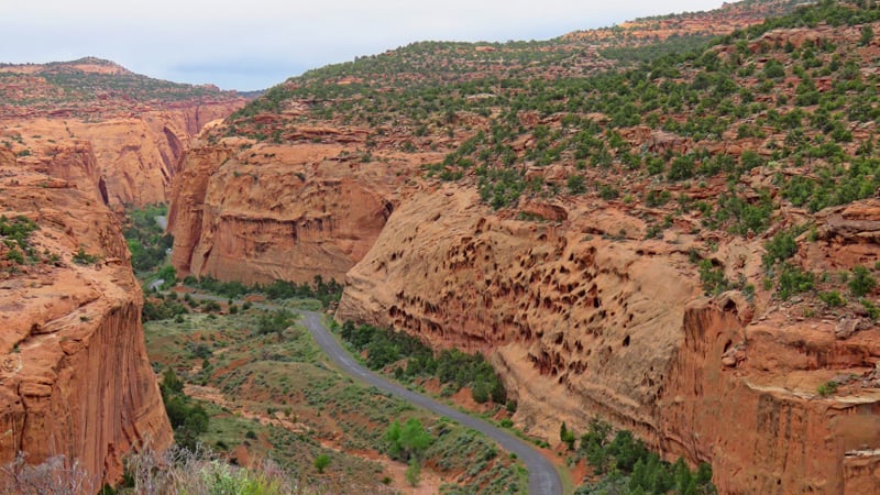
Above: Just a couple of the Burr Trail switchbacks
There is a nice road if you enter the Capitol Reef area from Boulder. In our opinion, it is not the best way to see Burr Trail Canyon. Travel from the bottom up is, to us, more exciting and not so hard on transmission and brakes. Enter a little chuckle here.
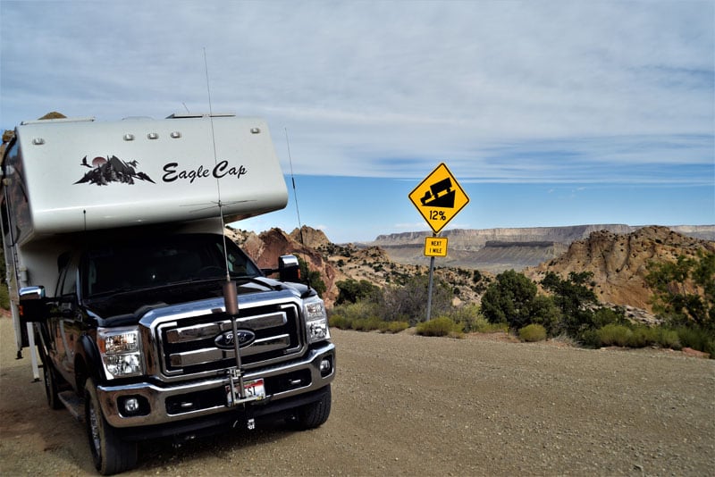
Above: Trusty Ford pulled the switchbacks
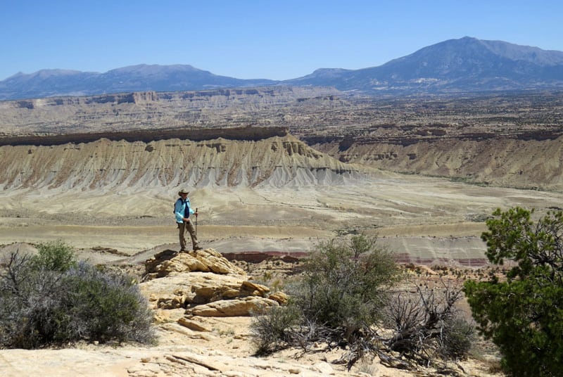
All of the Waterpocket Fold country is absolutely amazing with its geology whether you travel it from north to south or the opposite way from Bull Frog Marina.
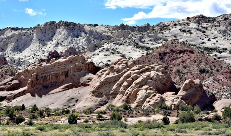
Above: Amazing geology hike in Water Pocket Folds
Camping is limited to just Cedar Mesa. We did not find anywhere else it was legal to camp. If the weather forecast is for rain we strongly recommend that you do not travel the Waterpocket Fold Road or the south road beyond the Capitol Gorge Road. The mud season makes many roads completely impassable. If you get a heavy rain while you are in the area stay put until the roads dry out. I am speaking from experience!
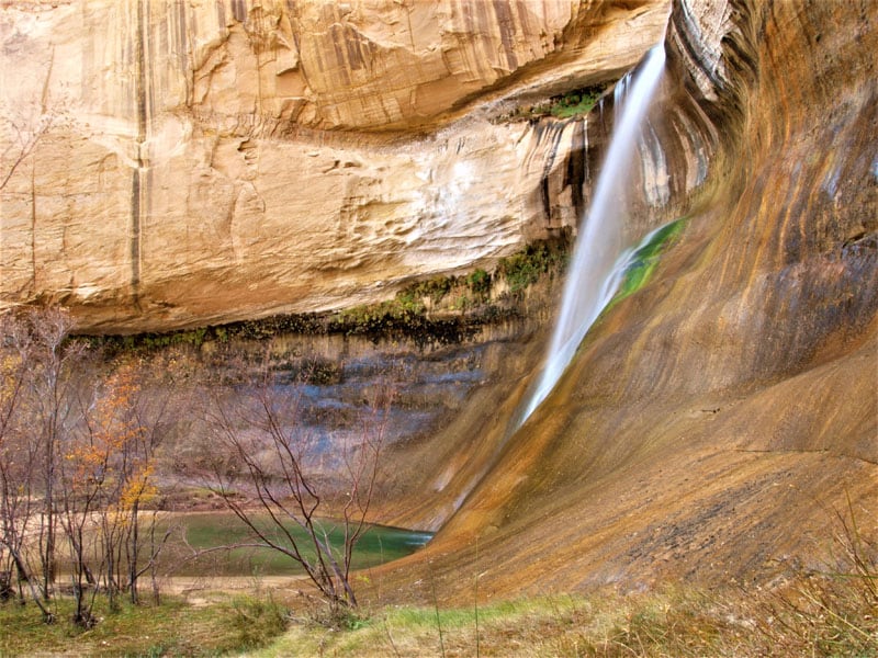
Calf Creek is a great little campground. You may find it full even in the off-season. The hike to Calf Creek Falls (pictured below) is fairly easy and well worth it.
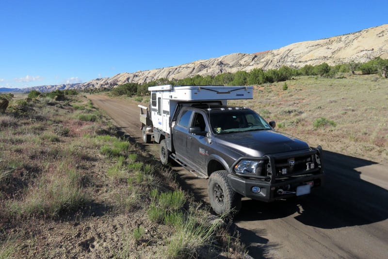
If the roads are dry we will be headed to the remote Cathedral Valley this spring.
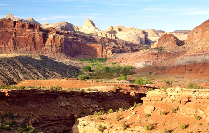
Fruita is nice any season. However, the spring season brings green-up and flowers without the summer heat. There is great hiking and the history of the area is rich and intriguing. The hikes in the Fruita area all semi-strenuous, but the views are awesome (pictured below).
If you take the time to bushwack hike in the Waterpocket Fold area, the country is beyond description. The Lower Muley Trail is also a great hike. Be sure to take plenty of water when hiking. If it’s at all muddy, it is not fun.
The drive south from there on the scenic route is awe inspiring, but gets into places where a large camper is not the preferred method of travel.
Janice and Randy Cooke
2013 Dodge Ram 2500
2015 Northstar Laredo
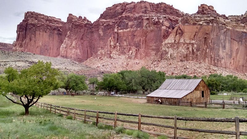
Within a short walk from our shaded campsite in Capitol Reef National Park was a farmhouse from the early Mormon settlers. The farmhouse had been transformed into a mini-museum and store with temptations including fresh-baked pies, breads and cinnamon rolls.
The Gifford House is a modest four-room, stone building that supposedly held thirteen-children and their parents. A loft held all the brood of kids for sleeping, but where they ate downstairs is a puzzle. Each of the four rooms is no bigger than 9-feet by 9-feet!
The building is now the hub for Capitol Reef visitors stopping in for baked goods, period aprons, tea towels, sunbonnets, jams and other temptations. The homestead includes the most fertile and water-rich land in the area.
John Wesley Powell named this area the Waterpocket Fold because of the many water pockets or depressions in the Navajo Sandstone that collect and hold water. It is an oasis in an otherwise desert terrain.
Three-thousand fruit and nut trees, vegetable gardens and other produce plantings are made available for public harvesting from June to October. Campers can pick what they can consume during their stay, so the tradition of celebrating the earth’s bounty of this Eden continues.
To add further to the beauty of this setting, the original barn still shelters four horses who look as it they were selected for variety of color and visual effect. They graze leisurely creating postcard poses for photographers.
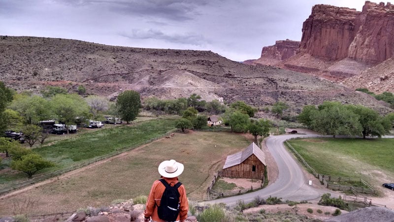
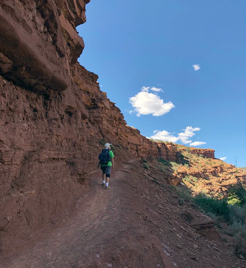
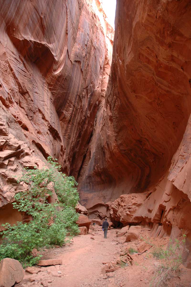
Directly across the road from the campground is the Cohab Canyon Trailhead. You can take a 3.4-mile hike into some of the northernmost sandstone features of the Waterpocket Fold, a 100-mile geologic treasure.
The first half hour of the trail rises steeply, but gives glorious views of The Castle and the Fruita Campground below. The trail levels and turns into a hidden canyon with sandstone cliffs, pock-marked walls with so many creative shapes that we felt like we were in a sculpture galley. One slot canyon, wide enough for one person and as deep as 100-yards, was especially memorable.
Cairns marked the sheer stone path when the sandy path ended. We took our time in this awesome gallery as it led us to the top of the cliff with a final sweeping view of the Fruita green valley and the surrounding multi-colored sandstone panorama.
Charles Coushaine
2001 Ford F-350
2012 Chalet DS116RB
We drove into Capitol Reef National Park via Scenic Route 24, and the views were spectacular!
Here’s a video of our drive into the park and our hikes.
We drove right past the visitors center and right to Fruita Campground inside the park. We were lucky enough to get the very last campsite open. It is a first come, first served campground. If it is full, you are out of luck because you cannot make reservations.
There were multiple beautiful hikes while visiting Capitol Reef. The first place we visited was the Gifford House to get a fresh made apple pie and cinnamon buns.
Next we hiked to see the wondrous petroglyphs that adorn one of the steep red rock faces just outside the campground. Another great hike was on the Capitol Reef Gorge Trail which leads to The Tanks; huge basins carved in the rock by flowing water.
Check out my scenic Route 24 video as well.
Bill Elwell
2016 Ram 2500
2016 FWC Hawk Flatbed
We’ve been through the Capital Reef area serval times over the years. Our early exploration was in a 1992 Mitsubishi Montero SUV. We were back again in a 2006 Jeep Wrangler. Our most recent visits were in our truck camper in May of 2017 and May of 2018. Both visits were tied in with trips to Overland Expo West.
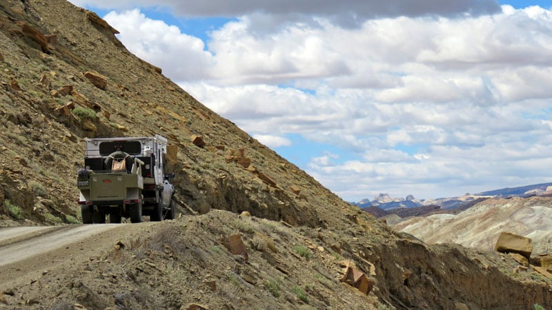
In 2017 we entered the park from the south along the Burr Trail. It is now a nice paved road, unlike our first visits when it was dirt.
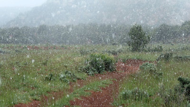
That year Utah had a cold spring and we were snowed on several times while in the area.
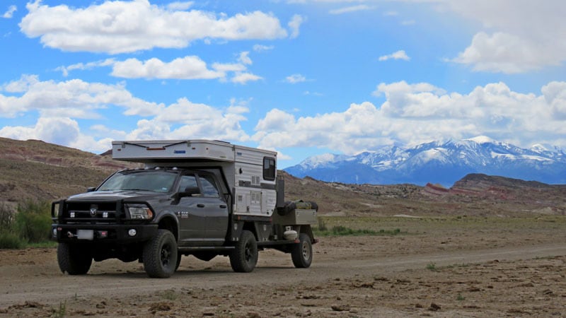
Since camping is restricted to campgrounds in the national park we decided to explore the Grand Staircase Escalante National Monument along the Burr Trail.
There are numerous side roads that go off into the hills up by the Circle Cliffs (pictured above). We completed a loop that brought us into the western fringes of Capitol Reef and then back out again to find a camping spot.
We didn’t see anyone else that afternoon. Maybe the snow had something to do with it. It was an exciting experience to be fully snowing with no visibility to lifting clouds with nice views of the cliffs.
The next morning we took the four-wheel drive road up Muley Twist Canyon (pictured above). The road runs up a wash and conditions vary depending on when water has flowed down it last. There are some flat sections, but much of it is crossing the stream bed, dodging boulders and climbing up and down the banks of the creek bed, often at a diagonal. In 2017 we drove it solo towing our trailer.
When we went back in 2018, with friends, we just parked the trailer at the start of the road and picked it up on the way out. It is a fun and challenging drive with plenty to see.
The road ends at a small parking area which is the start of a short hike out to Strike Valley Overlook. The trail goes out through the scrub and leads you to the edge of the escarpment for a scramble to the top to take in the view. It’s easy to spend an hour or two just wandering around and taking in the scenery. Back down the road there are interesting spots to stop and admire the scenery.
During our 2017 trip we were headed north and descended the switchbacks on the Burr Trail to Notom-Bull Frog Road and headed north to the rest of Capitol Reef.
In 2018 we came in from the north down Notom-Bull Frog road and exited to the south to Bull Frog Marina after an excursion up the switchbacks to camp and explore. The experience on the Notom-Bull Frog road will depend on when the last time a grader made a pass over it, and your tolerance for washboard.
In 2017 it was fairly smooth and damp with the freshly fallen snow. In 2018 it was heavily wash-boarded and dusty dry. On our 2017 trip we stopped in at the main visitor’s center which was crawling with people. We picked up information on traveling the Cathedral Loop and departed from the crowds.
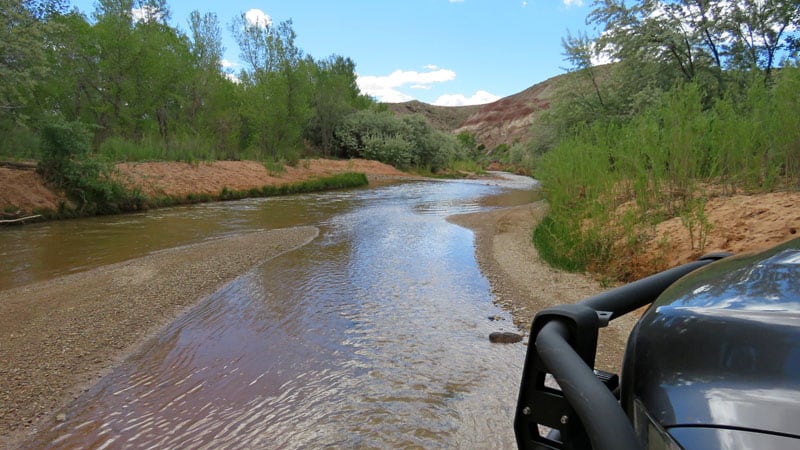
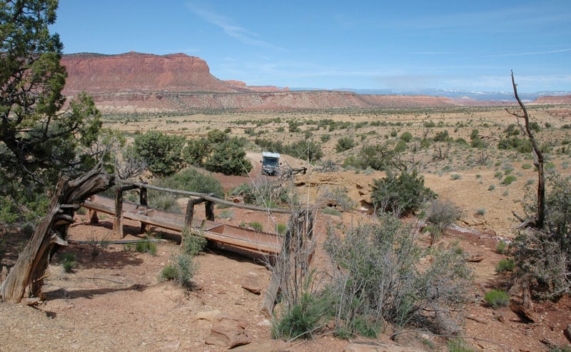
We had done the civilized part of the park on previous visits and were happy to leave that area to others. We headed out on our adventure on the Cathedral Loop. We decided to run it clockwise so that we would know we could make the river crossing at the start, rather than finding out otherwise at the end of the loop. The river was at a comfortable level for our truck so off we went (pictured below).
The road starts on the low lands and steadily climbs.
We were keeping an eye on storm clouds, trying to take in the sights and still make progress up to Cathedral Valley camping area which is first come, first served. There was evidence of previous ranching and a water well drilling rig.
The road climbs through a section of bentonite which we were concerned about with moisture falling out of the sky. It turns to grease when water is added, and there were some fairly steep climbs. We got above that area successfully and were feeling a little safer about continuing on up on the highlands.
We stopped at all the pull-outs there were; Lower South Desert Overlook, Upper South Desert Overlook, and Cathedral Valley Overlook. At the top of the climb our Plan B for camping was to head into the Fish Lake National Forest to camp if the park camping area was full.
Plan B was scrapped based on a big “Road Closed” sign due to snow. There was no shortage of snow above us. As it turned out, the camping area was mostly empty so we found a site protected from the cold wind and enjoyed the evening.
Great views were within a short walk of camp. The next day we were off to complete the loop, all downhill from here. There were great views along the way. There’s a little history at old ranching and cattle cabins.
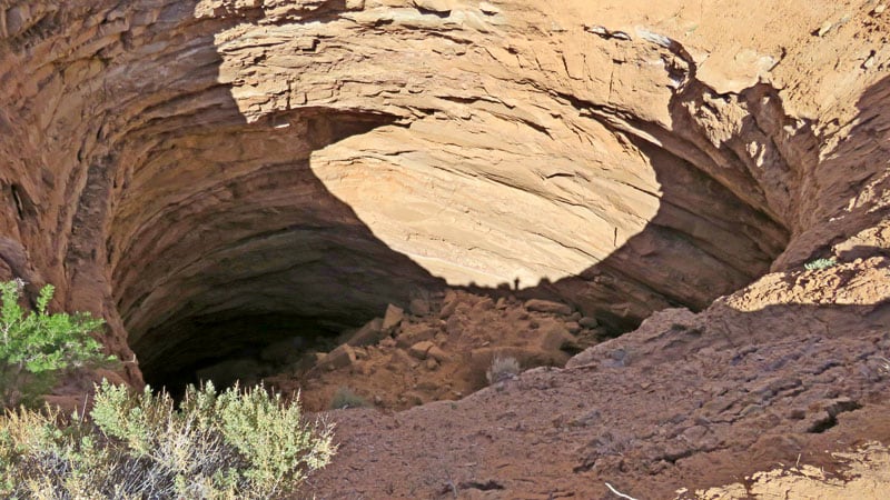
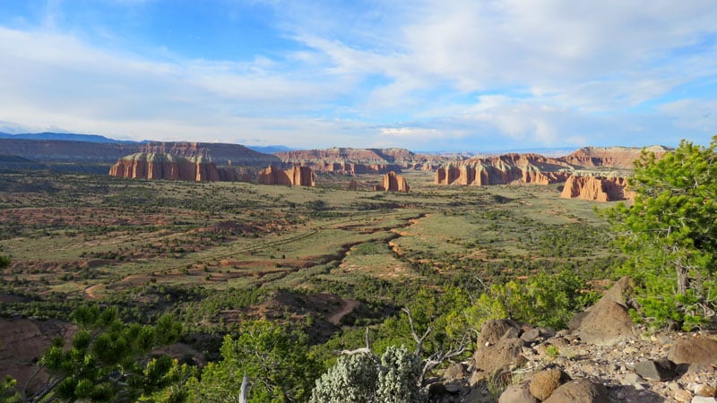
We took a visit to the gypsum sinkhole (pictured above) and Temple of the Moon and Sun area.
Our exit was out through BLM land with numerous opportunities to camp.
The next time our Plan B on camping will be to descend into the valley and find a place to camp there. The road runs along the river but does not cross it again before it exits back to the pavement of Route 24.
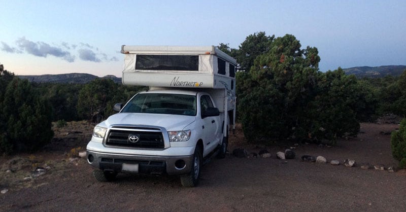
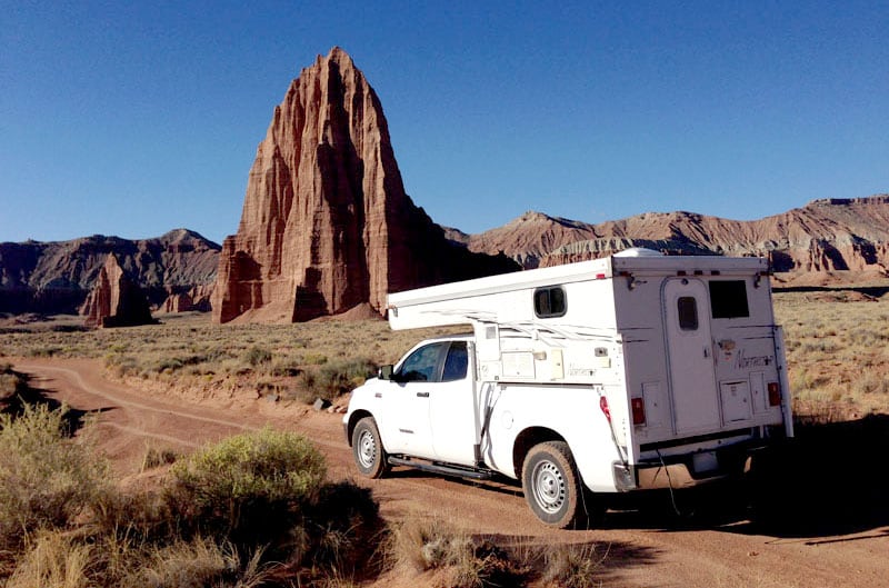
Carol Wegner
2011 Toyota Tundra
2010 Northstar TC650
We drove into the campground at Fruita and there were available sites at 10:30am, but there were also a multitude of people. The parking lot at the visitor’s center was overflowing with cars, RVs and tour buses dropping visitors.
As gorgeous as this area was, we decided to forge into the backcountry and Cathedral Valley. It’s a dirt road over 18-miles east of the visitor’s center and about 29-miles of dirt road back to a small campground with five campsites.
As we drove back, the clouds in the sky became black and ominous, dropping hail while the temperature was 77-degrees.
We passed four cars while driving into the valley. Gypsum Sink was a mile off the road and a good place for lunch. From there we drove on about five-miles through the cathedrals and up three rocky switchbacks to Cathedral Campground. Only one campsite was taken. A few hundred feet from our site we could look down on Cathedral Valley.
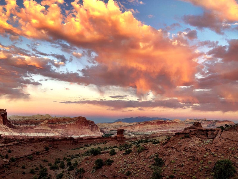
We enjoyed cocktail hour at the edge overlooking the cathedrals. We actually saw a car drive down the switchbacks, so make that five-cars, besides the two camped there. The sun kept playing peek-a-boo with the clouds.
We watched the light come and go until the wind began to gust and rain fell. Back in the camper the wind continued to blow, but the sun did come out without any black clouds around. Once we were in bed the rain began, along with thunder and lightening. One strike was so loud it seemed to be right on us. It seemed like the rain continued throughout the night.
When we got up between 6:30 and 7am, the ground was not overly wet, whatever rain had fallen had evaporated. We made coffee and started down the switchbacks and out of the valley.
The streams in the valley were running with enough water to make it a bit slippery as we drove, not to mention the mud that was kicked up onto the undercarriage of the truck. The camper was covered with red dust that was now streaks.
Above: Temple of the Sun, Cathedral Valley
Then we drove back to Glass Mountain and Temples of the Moon and Sun and out of the Valley of the Cathedrals.
Deb Hurlbut
2017 Ford F-250
2017 Northern Lite 9-6Q SE
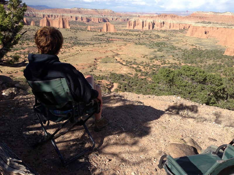
Gooseneck Point and Sunset Trail are not to be missed. The hikes to the lookout points are very close to the parking area and the views are majestic and awe inspiring.
Fremont Trail was gorgeous and deserted (pictured above). We felt like we had the place to ourselves. The trailhead is easily accessible from the Fruita Campground, ascending along rocky cliff walls to a panoramic viewpoint.
Above: View from Gooseneck Point
Fruita Campground is close to the visitor’s station, located along the eight-mile scenic drive. There are no electrical hookups at the campground. The bathrooms are clean, have running water and flush toilets, but no showers. There is a pull-through dump station and many trees for shade.
Without the sun at our particular campsite, we had neglected to deploy our portable solar panels to power up the battery, and then found that we didn’t even have enough battery power to operate the electric jacks to load the camper back onto the truck. Manual operation of the jacks was less than fun. Lesson learned!
The hike to Hickman Bridge (pictured above), which is a natural arch, was popular and well worth the trip. The trail’s difficulty is moderate since you hike between two large canyon walls.
John Dorrer
2013 Ford F-250
2014 Four Wheel Camper Grandby
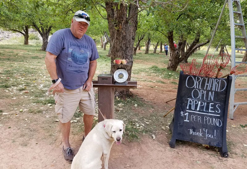
We stayed at Fruita Campground, picked apples and took the petroglyph tour offered by the ranger. We also purchased fruit pies at the Gifford House that were to die for. At the Capitol Reef National Park Campground we paid around $7 a night with our Senior Pass.
We drove deep into the canyon and should have continued to drive further.
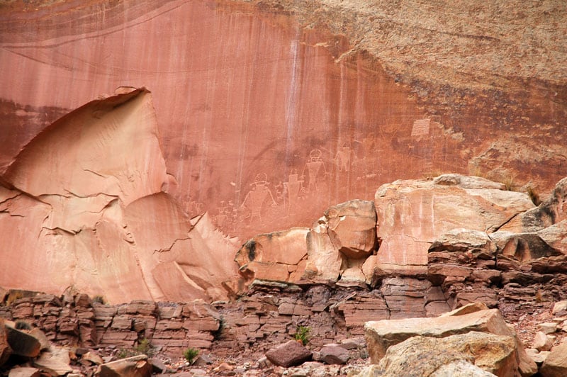
Above: Petroglyphs in Capitol Reef National Park
Laurel Wilson
2018 Ford F350
2016 Four Wheel Camper Grandby
Above: Bullfrog Norton Road
Within Capitol Reef National Park is the Norton-Bullfrog/Burr Trail Scenic Backway. We drove it north from the Bullfrog main campground near the marina. There was a place to park and a picnic table, but no electric hookups. There are flush toilets and showers. From the campground, the road to the place where the Burr Trail takes off was wide and dry, so it was an easy drive.
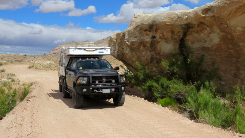
Where the Burr Trail left the well-maintained Backway was a different story. It crossed the Waterpocket Fold and consisted of a series of eroded switch backs as it crossed the Oyster Shell Reef. The road got better after it left the national park, but it was still gravel and not recommended for passenger cars. Truck campers should be okay.
Above: Water trough at Wolverine Creek on Wolverine Trail
We stayed on the Burr Trail until the Wolverine Loop, which is passable only in dry weather. We had one of the most magical, but unfortunately not photographed experiences on that loop.
We were driving along and all of a sudden a very large shadow passed over the truck. We jumped out to see a very large soaring bird overhead. Flying nearby was a vulture that appeared small by comparison. We thought it might be a California Condor and later learned that was correct. We watched both birds until they were out of sight.
We camped along the Burr Trail at the Deer Creek Recreation Area that has seven sites and vault toilets. We have also stayed at undeveloped Forest Service campgrounds in Escalante, but I don’t know which ones. All of those were dispersed sites with no amenities.
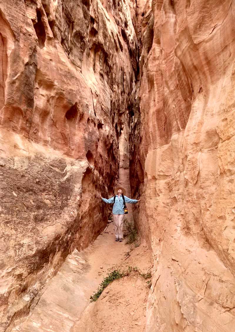
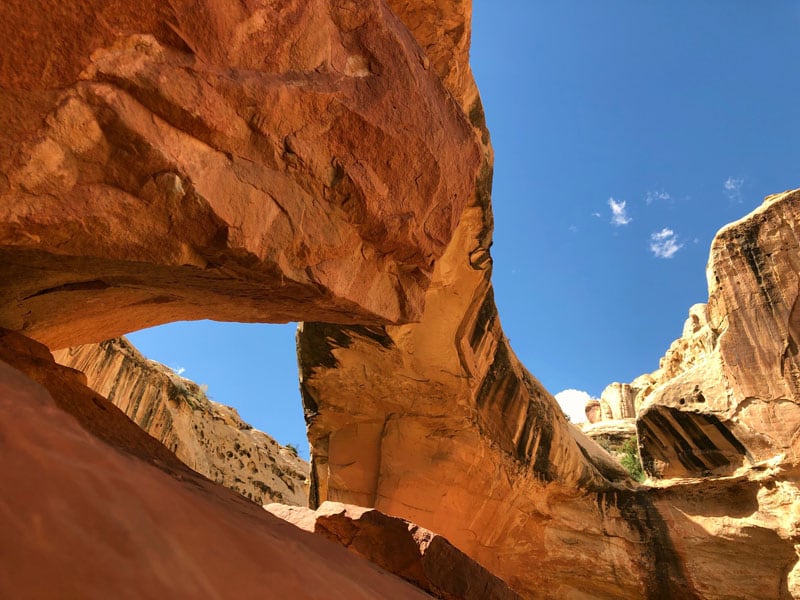
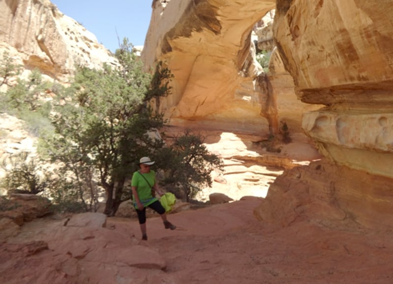
A slot canyon off the Burr Trail is a beautiful and short hike (pictured above). There are several nice hikes in Capitol Reef National Park, and most of them are fairly easy walks. The Grand Wash trail is an easy 6.25-mile hike round trip and the Capital Gorge trail trail is only 2.5-miles long and has some beautiful slot-like sections. There are many more challenging hikes that are also beautiful.
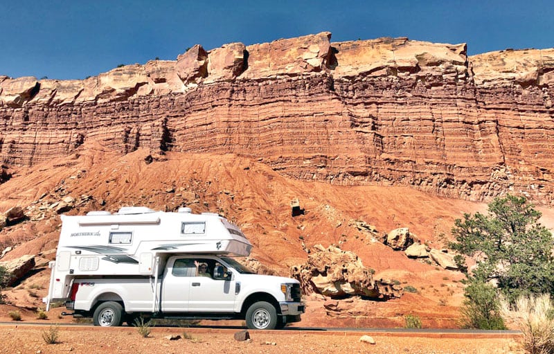
James Kaley
2018 GMC 3500HD
2018 Northern Lite 8-11
We recommend the Hickman Bridge hiking trail (pictured above). Allow at least two-hours for the hike. As I recall there was about a 400-foot vertical elevation change. There are definitely some ups and downs and some spots are sandy-slippery with loose rock and narrow trails. There are some small critters, so it is not a flip-flop for footwear location.
On a week day you might be alone, but on a weekend there will be crowds. It was bone dry when we were there, but if it was raining hard this trail would be tough and slippery in spots.
We were there for a week and made day trips to Grand Staircase Escalante and took the very scenic Route 12 toward Bryce Canyon. Since we took that drive on a weekend, Bryce was packed with tour buses, which made us glad that we had been there before. Route 12 is 124-miles each way, but was in good to excellent shape and has great spectacular views. You can top off your tanks in Torrey. It is absolutely worth ride and fuel.
We stayed at Thousand Lakes RV Park in Torrey, Utah. It’s a full-service commercial campground, but it’s outside of town, family oriented, and fairly quiet (the campgrounds in town were a little pricier and more urban). They have level sites, many with shade, laundry and a very decent restaurant that attracted people from outside the campground. There were lots of spaces, but I would get reservations.
We looked at camping in the national park. At the time we went (June of 2018) the National Park campground was first come, first served, and simply packed. The spaces were pretty close together and not large.
I also recommend the Capitol Gorge hike (pictured above). You can drive part way into the Gorge. Allow two-hours from the last parking area. The trail is only a mile, but there is a lot to see on it.
The hike is fairly level, but you will be walking on different surfaces; sand, rock, gravel, etc. There are places you can get up the side walls of the canyon on marked trails. There are get great views of the canyon, but be careful because you will have to use your hands. The sun is relentless and reflects off the walls around mid-day.
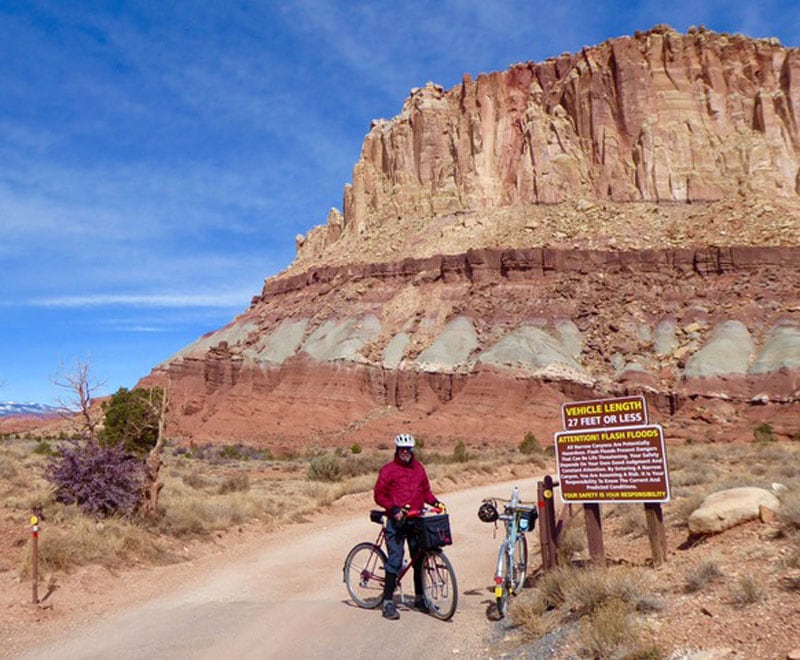
Please watch the signs and take the vehicle length limit signs seriously. We still laugh about the guy trying to turn the 38-foot Class C around and dragging his bottom and plumbing 150-meters past the no vehicles over 25-feet sign.
Danny Lee
2012 Chevrolet 3500
2010 Arctic Fox 812
We departed Tennessee in March to travel west and visit as many National Parks as possible. We arrived in Torrey and secured a campsite, and then drove through the park to visitor’s center in Fruita. There we gathered information and spend the evening.
That night, we returned to Torrey where the camp host invited us to a great barbecue and even took our orders for some great breakfast muffins. The next morning, after enjoying the muffins and coffee, we traveled back through Capitol Reef.
We stopped frequently throughout the day to enjoy the sites. I’ve gotten too old to hike, but made several strolls and took lots of photos. The park is very easy to travel with great access roads and some breathtaking scenery.
We also enjoyed two nights at Thousand Island View, and recommend it.
Keith Benefiel
2016 Ford F-150
2003 Hallmark Guanella
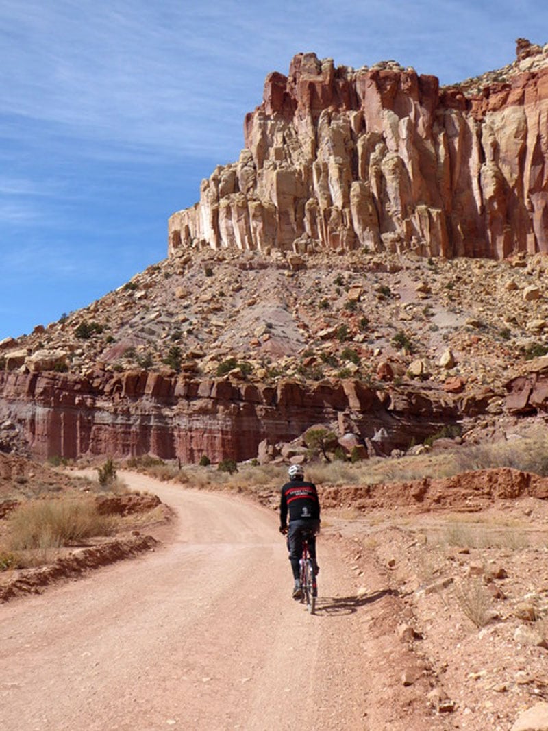
If there wasn’t so much hiking and biking to be done, one could gain 100-pounds from the fresh baked pies, sticky buns and good coffee 50-yards from the Fruita Campground. There are about twenty different varieties of pies, locally picked berries and fruit. And, oh yeah, it’s a cool park. There’s a great gravel road and mountain biking opportunities.
The big loop of the park goes from Notom-Bullfrog road to the Burr trail, to Boulder (eat at Hells Backbone Grill), to Boulder Mountain to Torrey. The small loop’s scenic drive is from south draw (unpaved) to Boulder Mountain to Torrey, Park. Schedule a couple weeks to explore the area.
In the area are a couple national parks, a dozen USFS campgrounds and unlimited boondocking. The Burr Trail is the most common.
Dave Rogers
2007 GMC Sierra
2007 Outfitter
I’m very sorry to say that we went once and will not go back to Capitol Reef National Park proper. We drove the Cathedral Valley dirt road loop and were so disappointed that no dogs are allowed on trails, even with a leash. We had a small dog at the time and hadn’t thought to check for dog restrictions.
We didn’t do any hikes and left right away. I understand the restriction because most people we’ve seen do not clean up after their dogs. We take a small hand shovel as well as doggie bags, but typically just dig a hole and bury it. Most national parks have dog restrictions and, for that reason alone, we do not visit national parks.
Jerilyn and Derek Simpson
2003 Ford F-350
2003 Lance 1150
We drove the scenic drive of Capitol Reef to see Egyptian Temple, the Golden Throne and Fern’s Nipple. Along Highway 24 you can take in Capitol Reef’s Castle and Capitol Dome where you can see petroglyphs in the stone carved by ancient Indians.
I also recommend Golden Valley State Park in Green River, Utah as well as a visit to Mushroom Valley discovered by Arthur Chaffin. It is a great place to walk about the rock-formed goblins.
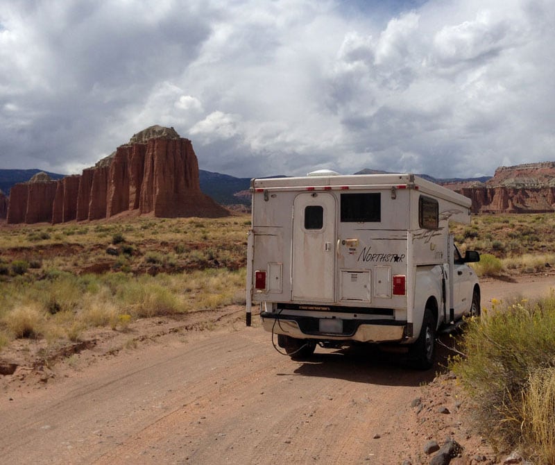
At Fruita Campground there are no hookups, but you can sit back in your chairs and take in the views of the reefs while deer come join you in campground.