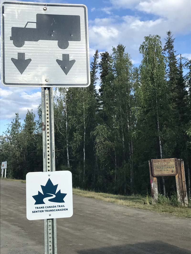
Ten fellow truck campers reveal where to go, what to see, and where to camp in the “Land of the Midnight Sun”. Kluane National Park, Tombstone Territorial Park, Dawson City, Dempster Highway, and endless boondocking are in the Yukon. Watch out for the “Bobs!”
Over the years we’ve talked to hundreds of truck camper owners who have taken the trip of a lifetime… to Alaska. While “The Last Frontier” remains at the forefront of Bucket Lists across the world, we can’t tell you how many times we’ve heard, “You know, Yukon was way, way better than we expected. We should have spent more time there. A lot more.”
If that introduction didn’t get your attention, how about this? Listening to the stories of those who have been there, Yukon sticks out as one of the top places Angela and I want to go – right up there with Alaska. We may need to purchase a Starlink satellite internet system to do it, but we are jonesing to make the long-distance run to Yukon. Perhaps when you see the following photos and recommendations, you will too.
Get your Bucket List out and a Sharpie. The consensus on where to go, what to see, and where to camp in Yukon was crystal clear. We can’t wait.
Gillian Holwerda
2003 GMC Sierra
1996 Bigfoot
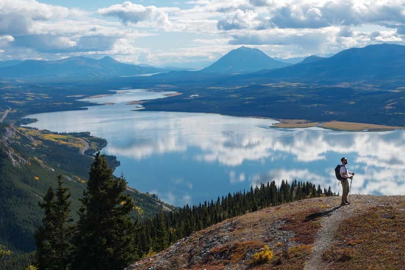
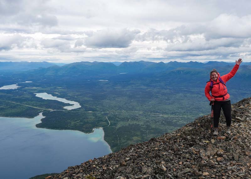
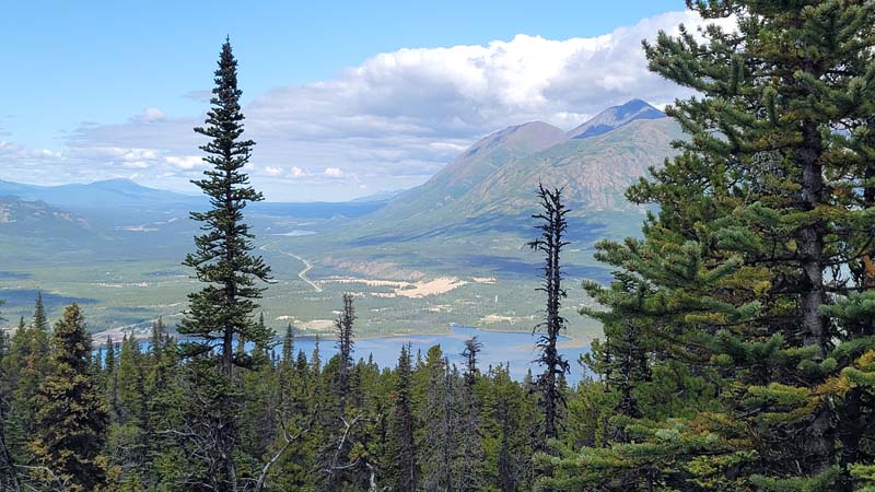
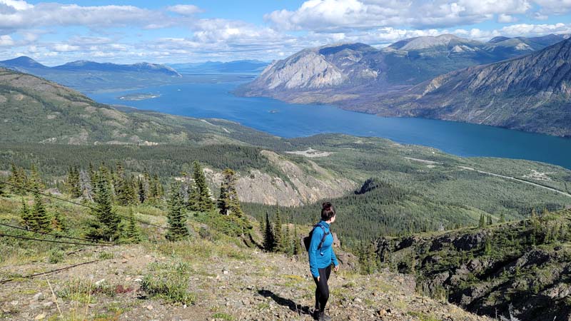
Above: Mount White’s incredible views of Atlin Lake, Yukon
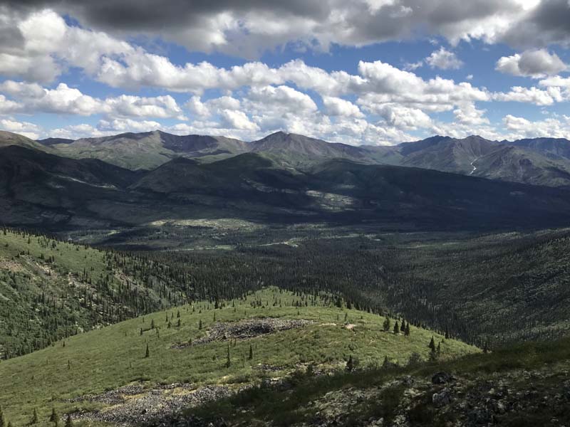
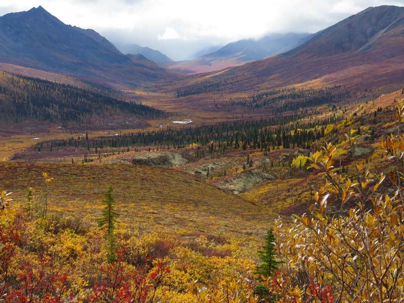
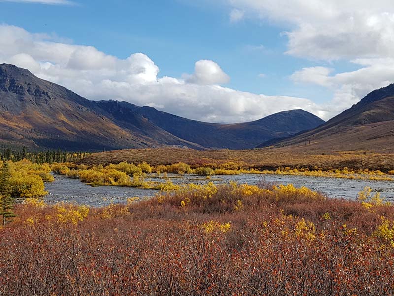
In September, the colors in Tombstone Territorial Park (pictured below) are simply incredible! The landscape in general is rugged and beautiful. It’s subarctic so the mountains are otherworldly.
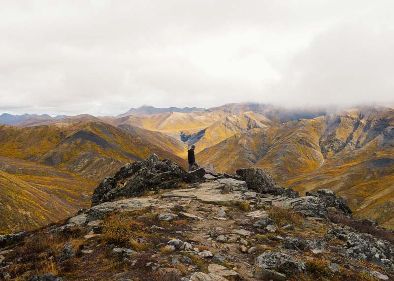
I would have never thought Canada had these crazy mountains. In my humble opinion, they are very different from the Rockies.
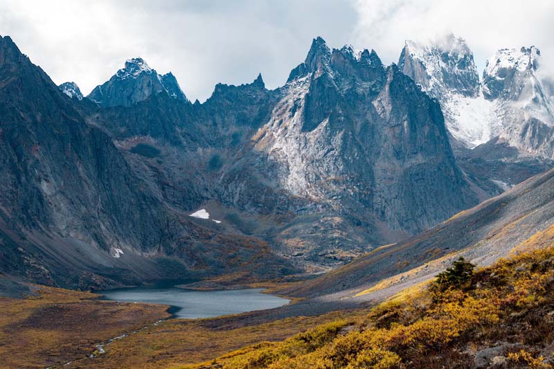
Above: Grizzly Lake in Tombstone
I highly recommend taking a multi-day hike to Grizzly, Divide, and Talus Lakes. You can also book a helicopter (it’s a 30-minute flight from Dawson City) to drop you off at Talus Lake where you can see the incredible Tombstone Ridge without having to hike in.
The Interpretive Centre at Tombstone is awesome and holds many free events. In September the fireplace was roaring and warmed some delicious Labrador Tea made free for visitors. The staff is very knowledgeable about the area, and the building itself is neat (made to freeze in the winter).
There’s a campground down the road, a ten-minute walk from the Interpretive Centre. If you purchase a permit in advance online, it’s $18 CAD a night, or $20 CAD if you simply show up. There is no cell phone service in the park. It is dry camping but includes a fire pit, picnic table, firewood, and pit toilet. My experience there will never be forgotten!
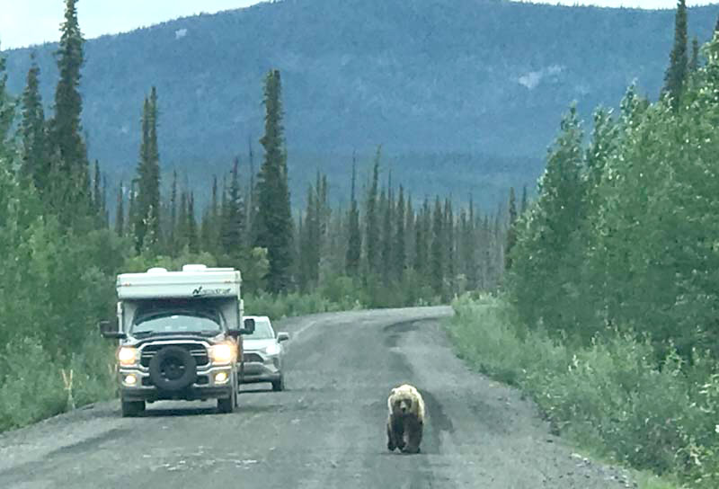
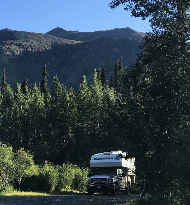
In Kluane National Park, you’re bound to see wildlife. In 2022 we saw grizzlies and a wolf.
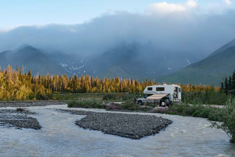
Above: Camping in Kluane National Park
There are loads of hikes in Kluane National Park, the most popular being King’s Throne. That hike gives you spectacular views of Kathleen Lake, which is so incredibly blue.
Above: View from Kings Throne, Kluane National Park
Top of the World Highway is beautiful. Just be aware that the border on this road closes for the winter. Pending on the weather, it’s typically closed beginning/mid-September until June. It’s one of the most scenic drives we’ve experienced! There are plenty of beautiful boondocking spots on this road as well.
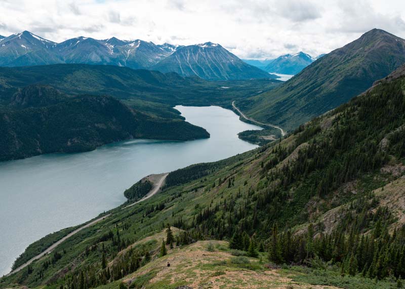
Above and below: Highway 2 From Carcross, Yukon To Skagway, Alaska
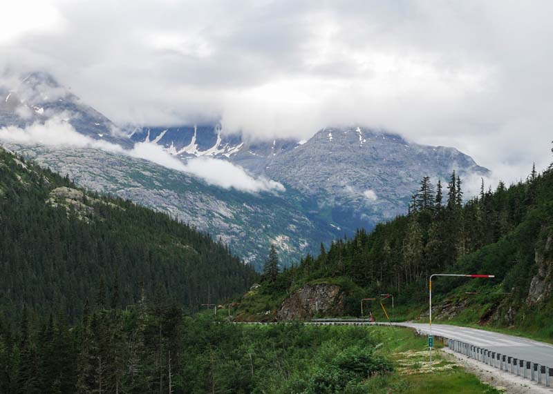
There are a few secondary highways in the Yukon that lead to Alaska with remarkable mountain views; Carcross, Yukon to Skagway, Alaska, or Haines Junction, Yukon to Haines, Alaska.
All Yukon Territorial Campgrounds are $18 Canadian if you purchase a permit in advance, or $20 Canadian if you prefer paying cash at the campground. They are all first come, first serve, and firewood is included in the price.
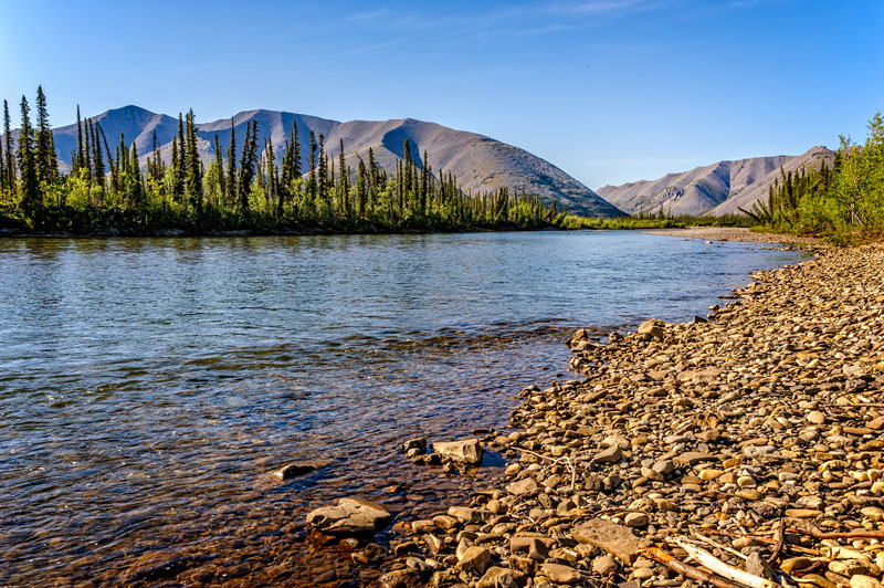
My favorite is Yukon River Campground. It’s just across the river from Dawson City and the only place I’ve seen a wild Lynx! It is beautifully treed with plenty of spots along the river and two nice playgrounds. There’s a short unmarked hike along the shore to three massive abandoned boats.
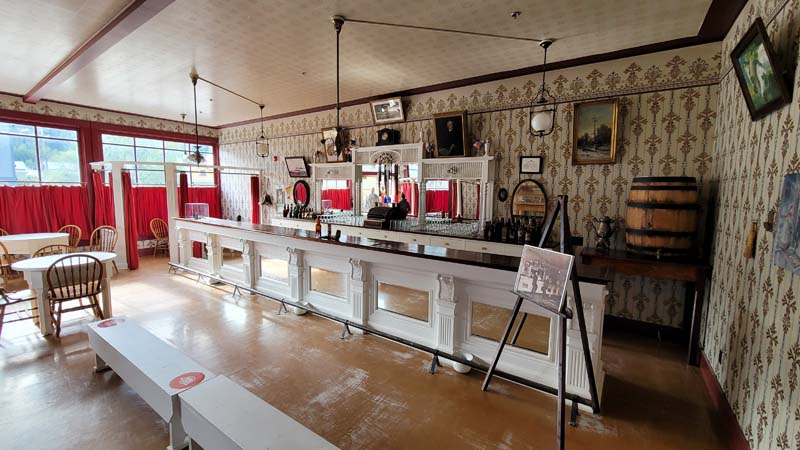
Yukon River Campground is in a perfect location to walk to the free ferry and take in a show at Diamond Tooth Gertie’s or gamble in the only casino in the Yukon. Don’t forget to kiss the toe!
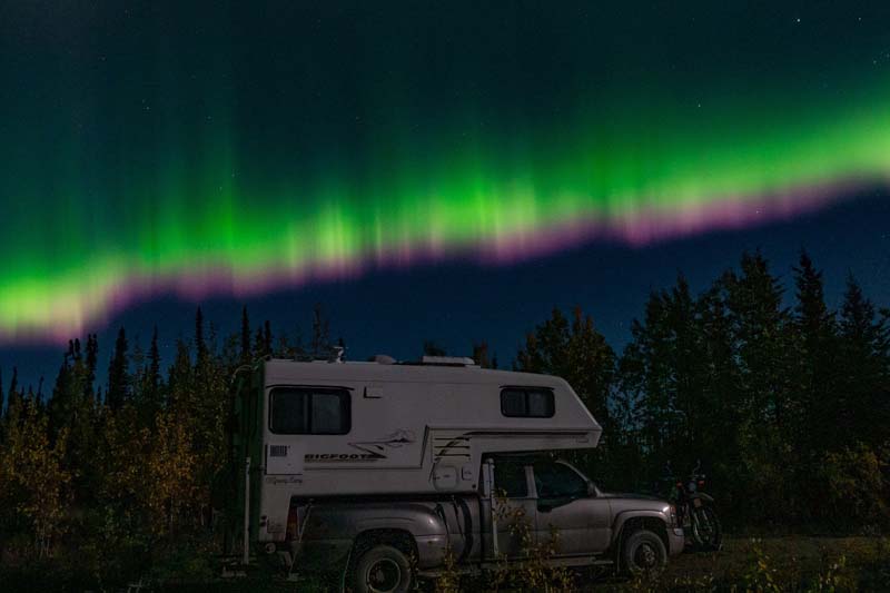
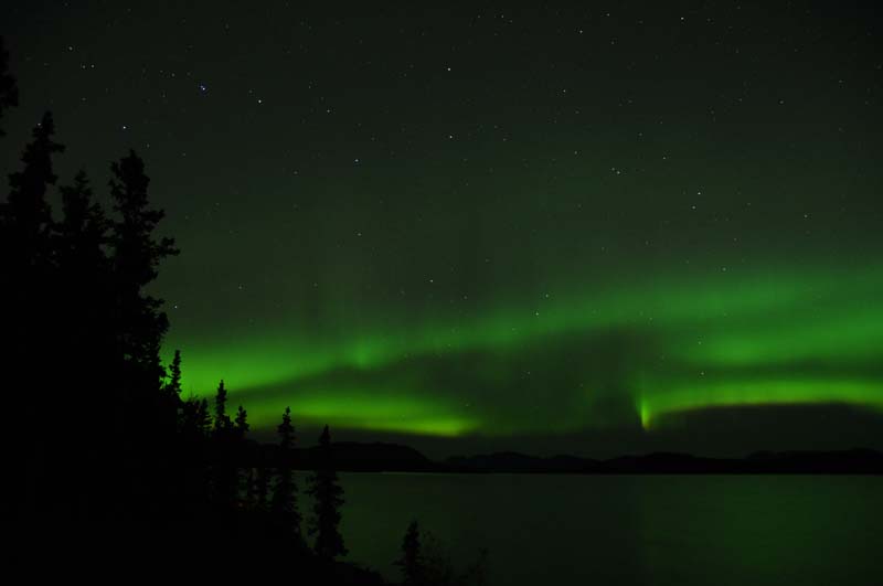
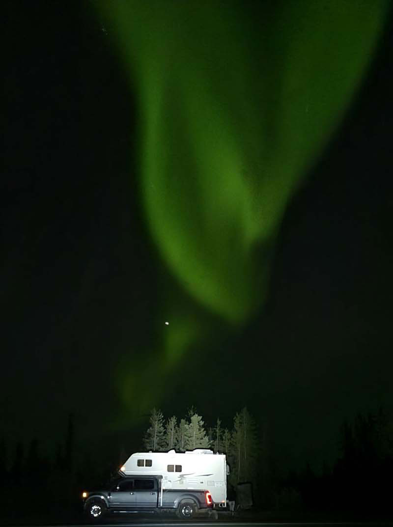
Above: Boondocking to see the northern lights, an hour north of Whitehorse
Check out more of our truck camping trips on Instagram at gramp.camp.
Marcus and Cindy Larson
2019 Ford F-250
2019 Capri Retreat
We left Tennessee in mid-May of 2022 and drove through the northwest United States, British Colombia, Alaska, and the Yukon for a total of 14,271 miles. We returned in mid-August.
We hiked 310 miles and lost 10-pounds each. We mainly dispersed camped, avoiding campgrounds unless a campground made sense with our hike.
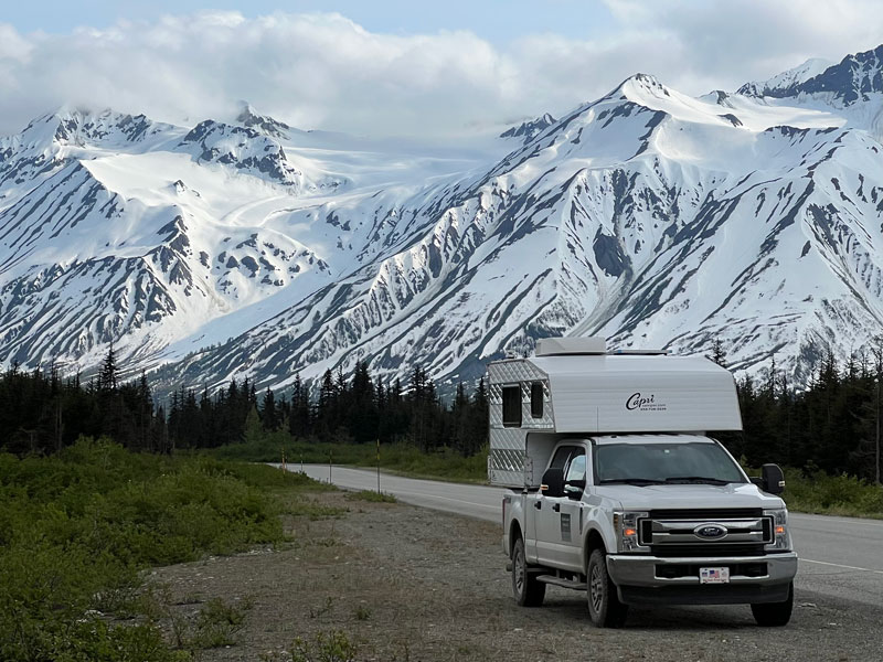
Above: Haines Highway, Alaska
We took a ferry from Skagway, Alaska, traveled up the Haines Highway, and entered Yukon. This area is stunning with four national parks that combine into the largest international protected area on Earth.
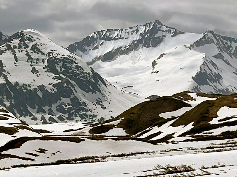
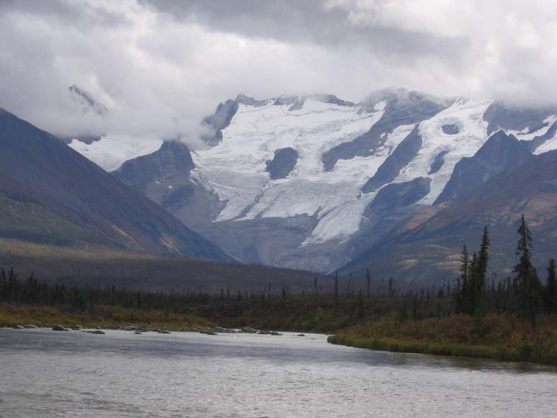
Above: Chuck Creek Trail to Samual Glacier off of the Haines Highway
We hiked and camped for several days in the Kluane National Park. Chuck Creek to Samual Glacier and Kings Throne were two amazing hikes as we headed north to Alaska.
After driving, hiking, and camping through Alaska, we reentered Yukon on a ferry across the Yukon river near Dawson City.
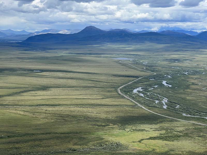
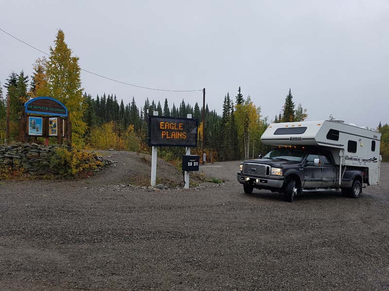
Above: Dempster Highway, Yukon
From there we headed up the Dempster Highway 600-miles to the Arctic Ocean at Tuktoyaktuk.
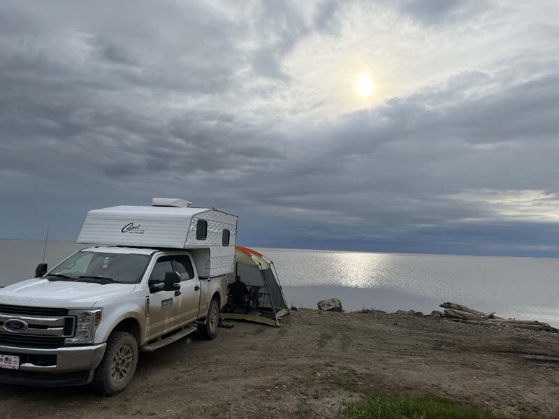
Above: Camping next to the Arctic Ocean, Tuktoyaktuk
On the way and back, we stopped and hiked in Tombstone Territorial Park to Grizzly Lake (15 miles) and summited Surfbird Mountain on our return route. If you’re a hiker, this park is a must-see; the tundra, permafrost, moose, and grizzlies.
The Dempster Highway is a dirt and gravel road leading to the Arctic Ocean. It can be tame on dry days and sloppy after a lot of rain.
The Campbell Highway is another dirt gravel road that leads to off-the-beaten-path discoveries and offers camping on the Liard, Francis, Ross and other Yukon rivers.
Above: Liard River off the Campbell Highway
In the Yukon, your boondocking options are endless. We rarely stayed anywhere for more than a day as we moved on to the next hike.
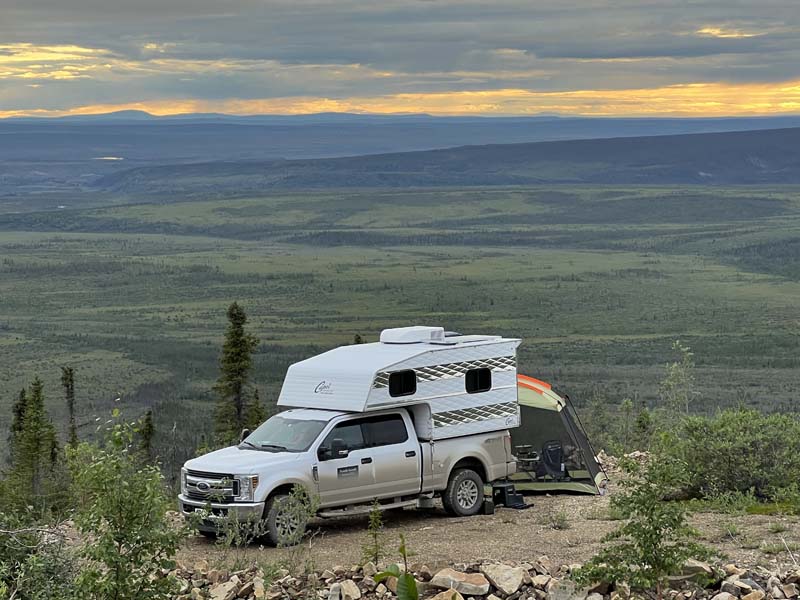
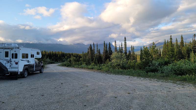
Above: Camping on the Dempster Highway past the town of Eagle
That said, our favorite sites were found along the Dempster Highway past the town of Eagle overlooking the tundra.
Camping off the Haines Highway near Tatshenshenini Provincial Park is remote and beautiful. Off the Campbell Highway, Liard River Canyon Campground is primitive, beautiful, and remote. Spots on the river were available when we were there.
Chris Stone
2021 Ford F-250
2022 Northstar Liberty

My favorite place in Yukon was Tombstone Territorial Park (pictured above).
Above: Be ready for a dirty truck on the Dempster
It is about 75 kilometers up the Dempster Highway, which is a dirt road.
Above: Don’t forget to air down your tires on the Dempster
There you can get away from the big rig RVs in Tombstone.
Above: Viewpoint on the Grizzly Lake Trail In Tombstone
The scenery is beautiful and there are some great hikes. I recommend the Grizzly Lake Trail for some stunning views.
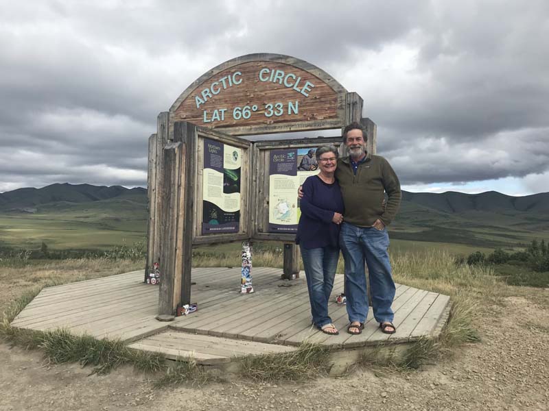
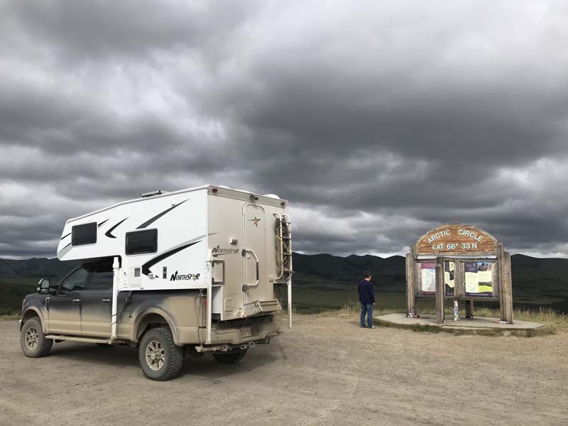
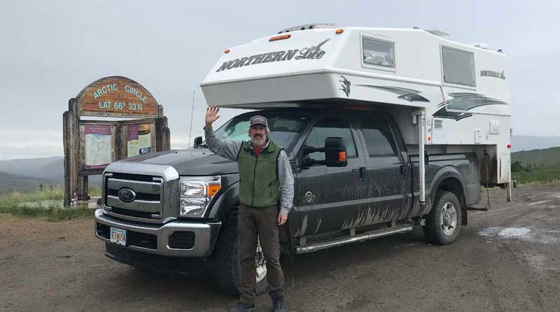
Above: Chris Stone and Sue Elgar standing at the Arctic Circle
Be sure to continue up the Dempster Highway to the Arctic Circle just for the momentous feeling of standing on the Arctic Circle.
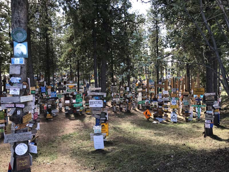
My second favorite place was the Watson Lake Signpost Forest. It is a truly unique place with thousands of signposts from around the world left there by visitors to the Yukon.
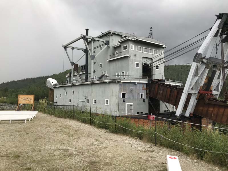
Above: A Klondike dredge in Dawson City
There are Yukon Territorial campgrounds all over the Yukon. They don’t have hookups but truck campers don’t need them. We have a cassette toilet so we could empty that into the pit toilets and we didn’t need a dump station.
Yukon Territorial campgrounds are cheap ($20 CAD). Even better, the big rigs can’t fit in them and we like to get away from the big rigs. The campgrounds are all self-register so no reservations are required. We never had any trouble finding a campsite in these campgrounds.
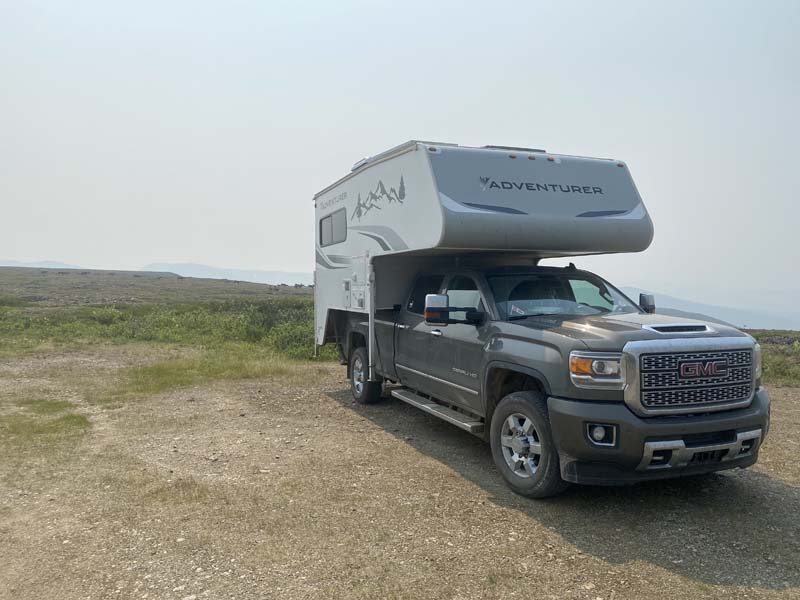
David Anderson
2018 GMC 3500HD
2020 Adventurer 89RB
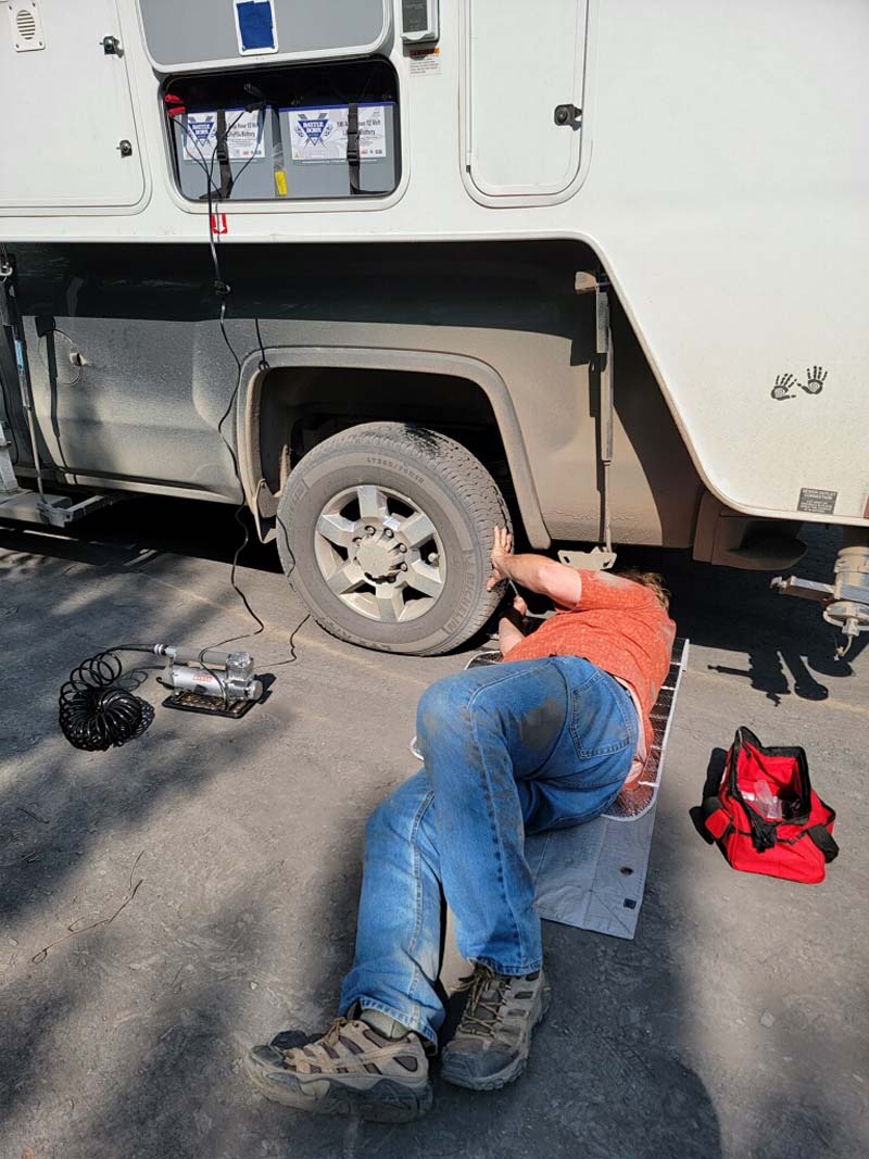
Above: Changing our first flat tire on the Dempster Highway
During our travels north, we spent eighteen days in the Yukon. I want to share a small portion of our trip on the Top of the World Highway.
After getting our tires repaired at the local Napa store in Dawson City (another story from a different highway) and fueling up with diesel, we got in line at the ferry. The ferry over the Yukon River carries everything from small cars to giant semis.
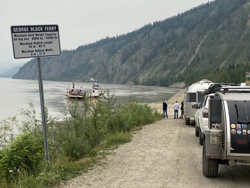
Above: Waiting for the George Black Ferry over the Yukon River
The Yukon River’s flow at this time was extreme with numerous major flooding issues upstream. We were warned that if the current got any stronger, they would temporarily close the ferry. Fortunately, we loaded up and the ferry struggled against the current and got us across.
After exiting the ferry, a short drive will bring you to the Yukon River Campground. This is a beautiful campground operated by the Yukon government with about 90 sites, pit toilets, and no potable water. We would have liked to stay there but mild temperatures and heavier-than-normal rainfall made the area perfect for mosquitoes.
Trails from there take you to Paddlewheel Graveyard, a place on the river where long ago aging paddle wheelers were left to decay.
The Top of the World Highway is only 127 kilometers in length measured from its beginning at the Yukon River ferry to the junction in Alaska with the Taylor Highway. At its highest point, it rises to 1,376-meters (4,515-feet). It’s paved for only the first few kilometers where the highway begins its steep climb from the Yukon River.
Apparently, the entire highway was paved in the 1990s but pavement at this climate and altitude doesn’t last, so it is mostly gravel at this time.
Despite the gravel, I found the highway to be a real pleasure to drive on as long as you keep your speed at or below 90 kilometers per hour. Any faster and you wouldn’t be able to react quickly enough to the occasional irregularity in the road surface.
A popular driving technique is to follow a fast driver, “Bob”. The name “Bob” comes from the motion of their vehicle after hitting a bump. When you see “Bob’s” vehicle react violently to the road surface then you know to slow down before you get there.
This drive can be covered in a relatively short time. Slow down and enjoy the amazing vistas of rolling high alpine mountain tundra.
Unlike the cloudy and rainy weather we had prior to our arrival, we had sunshine and clear skies. Most of the mountain tops were treeless and covered with wind-swept ground cover of heather and lichen. This is obviously a place that most animals and humans would not like to be in the winter. But there is one animal that thrives in this summer environment which we would be very lucky to see.
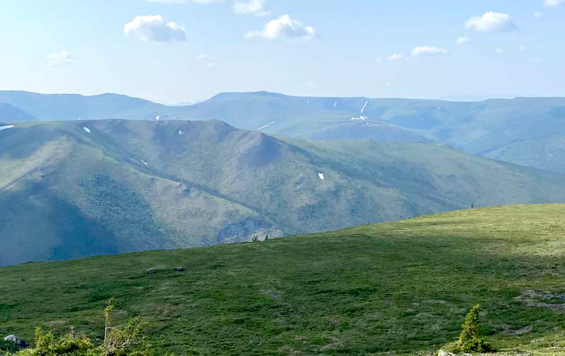
Above: High alpine tundra along the Top Of The World Highway
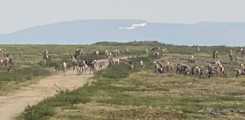
After a few hours of driving and stopping for the views, we arrived at a pullout just a few kilometers from the Canadian and US border. A short walk up a trail brought us to the highest point on the Top of the World Highway. However as we climbed up the last short grade before that pullout, we came upon a herd of several hundred caribou.
It was an amazing scene to witness as they were right alongside the road stopping only briefly to graze on the lichen. We could have crossed into Alaska that day but decided to camp out at this incredible place. Just a few kilometers away we could see the border crossing.
The weather couldn’t have been better with temperatures in the 60s, some clouds, and a constant but gentle wind. Much to our joy and completely unlike the lower altitudes, there were very few mosquitos.
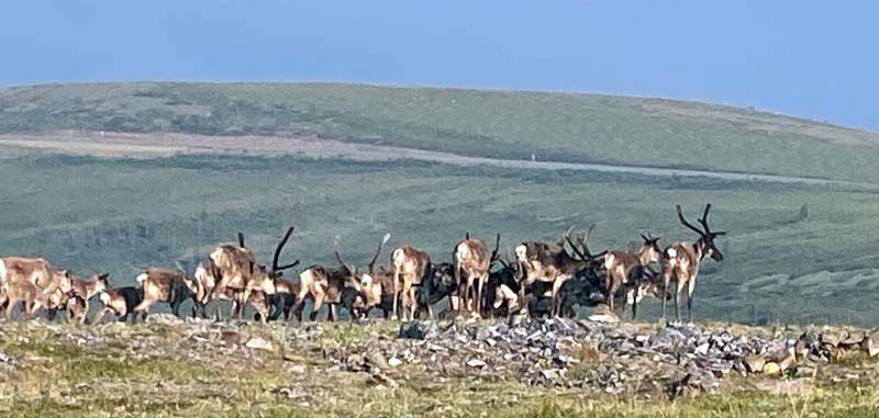
Before we even had a chance to set up camp, another herd of caribou came right through, and then another, and another. There were so many caribou that after a few hours we went inside the camper and left the rear door open so that we could continue to watch them. As they went by, we listened to the odd clicking sound of their hoofs on the rocky ground.
Sleeping that night came easy despite the brightness of a sky that never seemed to get dark. It was around midnight when my wife woke me to see even more caribou passing by our camp. We watched this for 30-minutes. I was too tired to stay awake and went back to sleep. The next morning (it never really got dark out) had us up with coffee in hand, the back door open, and hundreds more caribou trotting past within 50-feet of our back door.
Later that morning we packed up for the border crossing. We got all the usual questions; “Got any raw chicken? Eggs? Peppers? Marijuana?, Tactical ballistic missiles?” It was no to all of those, so we were free to enter Alaska.
Before we left I asked about the caribou we saw. A smile came over the border agent’s face as he said that the spot we camped at is an area commonly used for the caribou migration. He said that thousands cross here and within a few days, they’re gone. We were incredibly lucky!
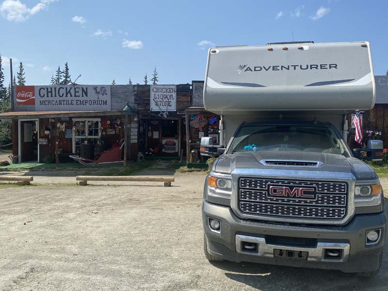
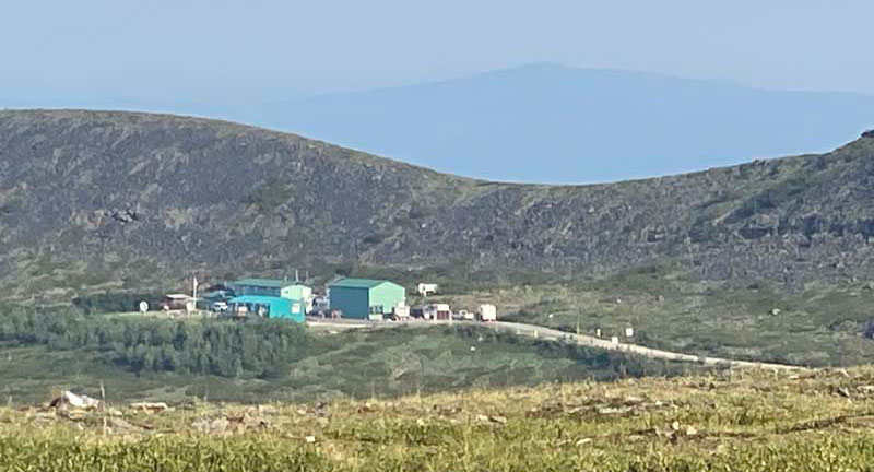
Above: Old cafe and store in Chicken, Alaska town
Proceeding into Alaska, past at least one huge gold mining compound, the road was paved and relatively smooth until we reached the Taylor Highway. The roadway became twisty with gravel until we reached Chicken, Alaska. Between Chicken and Tok is perhaps the worst stretch of highway in the state of Alaska.
Celina and Brett Binns
2022 Ford F-550
2014 Arctic Fox 1150
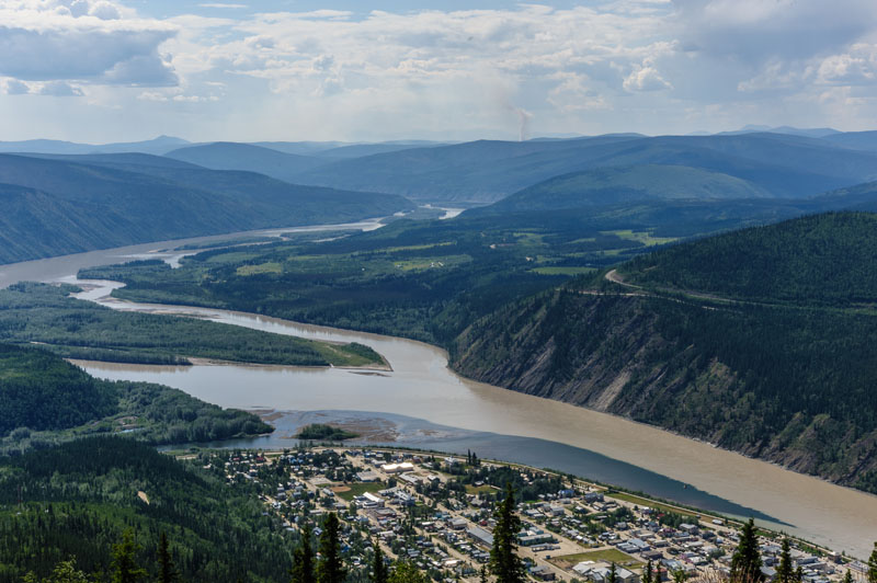
Above: Yukon River Valley from the Midnight Dome, Dawson City the day after the solstice parties have ended, photos taken by Brett Binns
It’s hard to pick a favorite place in Yukon, but I would probably say Dawson City.
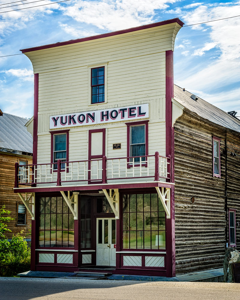
Above: Yukon Hotel on Front Street in Dawson City
We stayed at Gold Rush Campground RV Park. We paid $37 Canadian (in 2015) for a site with water and 15-amp electricity. The nice thing about this campground was that it was right in town, so we could walk to just about everything.
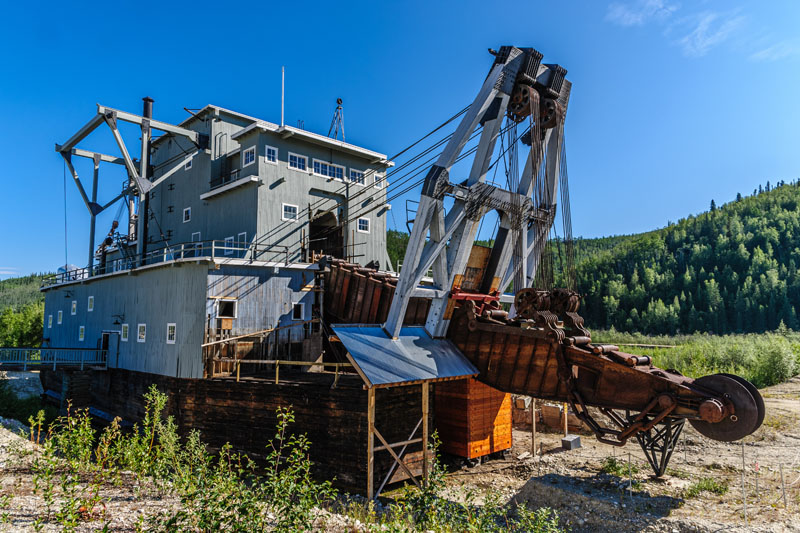
Above: Front Dredge arm end of #4
From there, we drove up the Dempster Highway.
Above: Elephant Rock Pullout, Km 221.2 of the Dempster Highway, Yukon
We also enjoyed visiting Whitehorse. There we stayed at the Robert Service campground which is run by the town. It is primarily a tent campground, but they had some spots they use for RVs. Essentially you park in the spot a tent camper would use for their car. It’s not beautiful, but it is close enough that you can walk along the river into town. The sites were $20 Canadian per night.
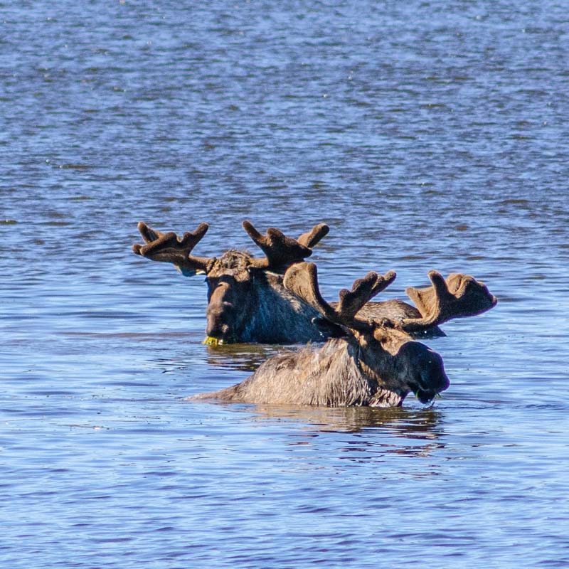
Above: Two moose at Two Moose Pond along the Dempster Highway
The Yukon Beringia Interpretive Centre is interesting if you like natural history. And a stop at Yukon Brewing is a must!
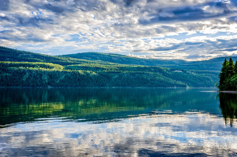
Above: Fox Lake Yukon Government Campground, Fox Lake, Yukon
We also enjoyed several Yukon Government Campgrounds (YGC). Fox Lake YGC is on a beautiful lake with mountain scenery all around. Engineer Creek YGC is along the Dempster. Engineer Creek was beautiful but the mosquitos were thick! When we were there in 2015, unserviced sites at YGC were $12 Canadian and came with all the firewood you could use.
Above: Top of the World Highway just outside of Dawson City, Yukon
Leanne Ellard
2006 Ford F-350
2001 Lance 1121
Following the advice of the folks camping next to us in Whitehorse, we ventured out to Tombstone Territorial Park and discovered the most beautiful place we have ever set foot.
The Dempster Highway (pictured above) started out as an adventure with the rain and the merciless potholes smattered about.
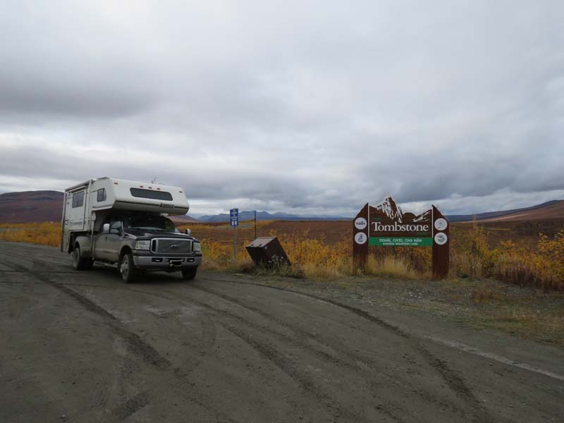
Above: Tombstone’s north entrance
As we entered Tombstone Territorial Park, the sun broke through and offered an opportunity to experience the vast wilderness, open spaces, and landscape ablaze with vibrant autumn colors.
The truck and camper wore the Dempster badge of honor dirt for a few days while we explored this magnificent northern territory.
We stopped at the Interpretive Centre to gain a better understanding of the park. Then we secured a riverside campsite for the night and headed further north to see what this spectacular park could offer. Every turn in the road offered a view that seemed more beautiful than the last and a feeling of seeing something so special, that you dare not blink as it may be a dream.
The campground offered trailheads with many views not seen from the highway. The air was cool and there were few bugs to interfere with a couple of hikes and cooking dinner over an open fire. The Yukon Territorial campgrounds are very affordable and include free firewood.
The bald mountains offered a magnificent view of all Mother Nature can offer to those willing to explore this vast terrain.
Marsh Lake Campground, just south of Whitehorse, offers large lakeside campsites away from the highway noise. It is large enough to take a long walk around the bays and stretch your legs after a day of driving.
Steven Gasser
2013 Ram 3500 SLT
2003 Adventurer 90FWS
Above: North Canol Road, Yukon Territory
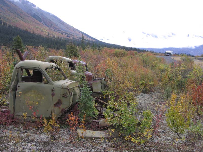
We lived in Whitehorse, Yukon Territory from April 2004 to May 2009. Every summer we completed a two-week road trip following one of the many scenic routes out of Whitehorse. Almost all of these trips could be called memorable, but I would highlight the trip we did up the North Canol Road in search of World War II truck and equipment parks.
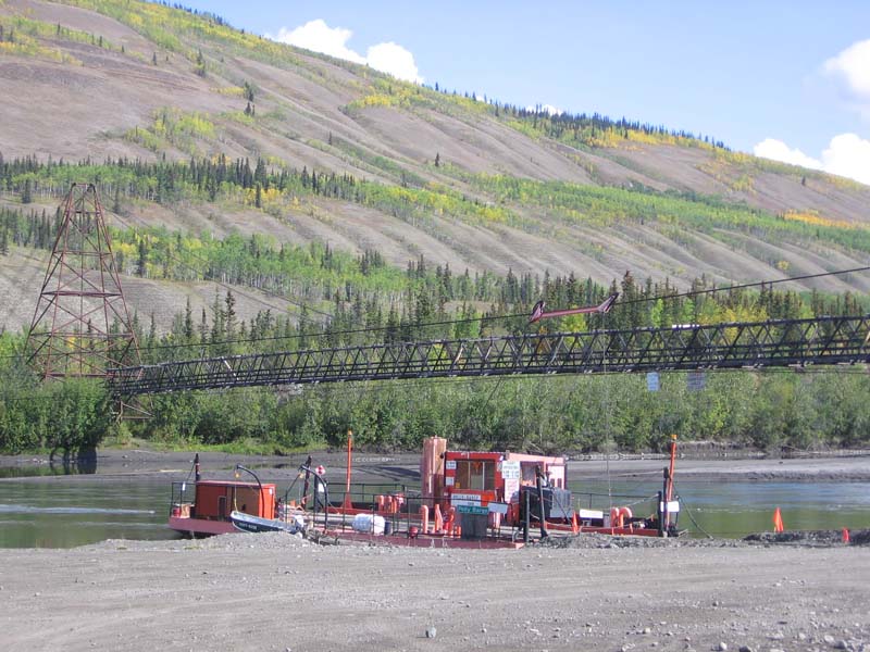
We left Whitehorse for Ross River and refueled. Then we crossed the ferry (pictured above) and headed northeast along this famous World War II service road that is unmaintained. This was over the Labor Day weekend and snow could be expected at that time of year.
We arrived at the steepest section of the road and experienced heavy rain and descending temperatures. Since we had not brought chains, we turned around and headed back to the last lake to camp overnight and see what the weather would bring.
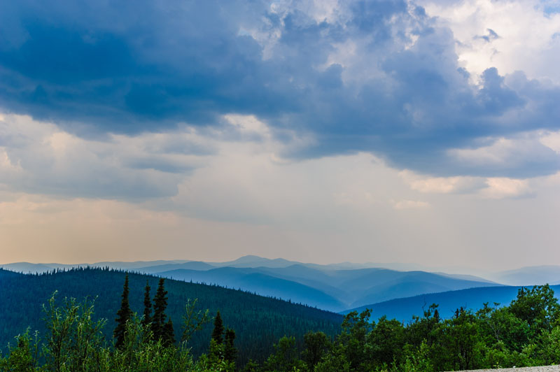
Above: Scenery along the North Canol Road
The next day brought bright blue skies and warm temperatures, so we continued on our way. The rest of the trip was beautiful mountain scenery all the way past the Northwest Territory border to the first river ford. The bridge had been removed due to disrepair. Since we were on our own, we didn’t want to risk getting stuck. That was our turnaround point.
As I said earlier, the road was unmaintained and covered with potholes. The fastest that we could travel in some sections was 30 to 40 kilometers per hour. By the time we had reached our camp spot for the first night, I had replaced two turnbuckles that had snapped or pulled apart due to the twisting and bumping of the camper. That trip convinced me to change to Torklift tie-downs. My wife also told me that was the last gravel road camping adventure for that season.
If you decide to do this trip, make sure that you are prepared for anything. We had UHF-VHF radios and the Government of Yukon frequencies, as well as a tire repair kit (which I had to loan to someone else) and spare turnbuckles. We monitored our fuel gauge and turned around before we had used half the tank. Be prepared and have fun!
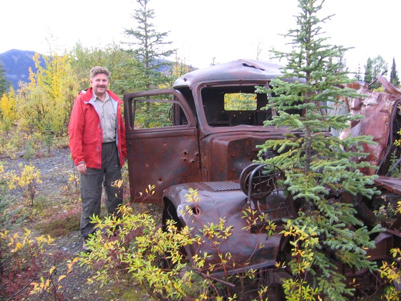
Above: Steven with abandoned truck
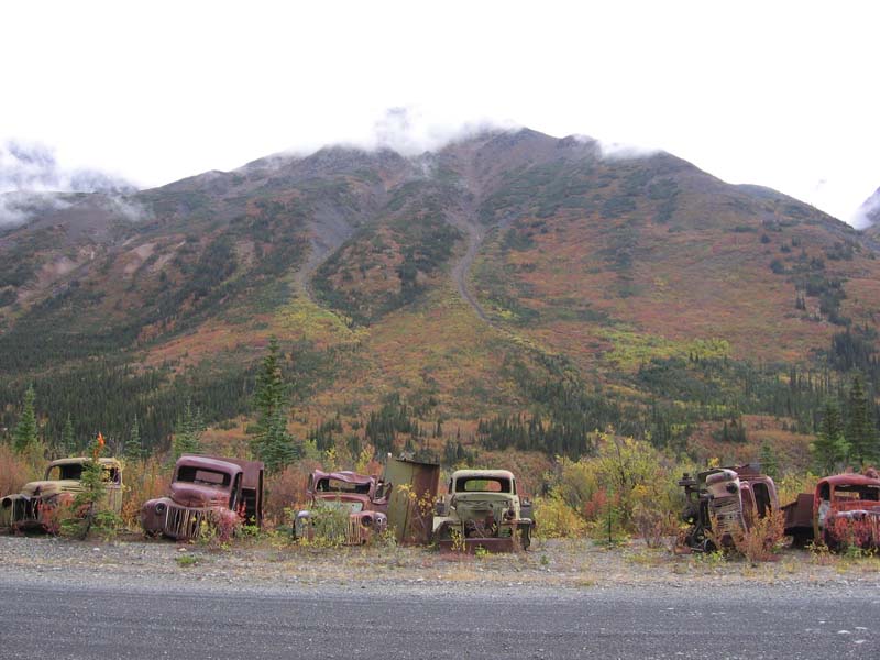
Above: WWII vehicle park
The South Canol Road is spectacular and takes much fewer preparations to drive. It is very worthwhile, especially in the fall; late August or early September.
Most of our camping was boondocking wherever we wanted. Our favorite campground was at the Tombstone Territorial Park on the Dempster Highway. All the Territorial Campgrounds are well rustic, well-maintained sites and worth stopping at. If you are going to stay more than five nights in the Yukon, buy a season’s pass in Watson Lake on your way north.
George Dunstan
2010 Ford F-450
2009 Lance 1055
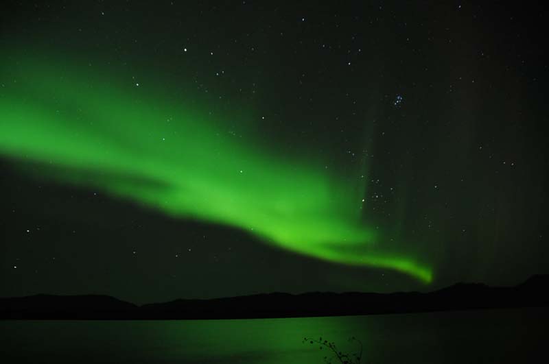
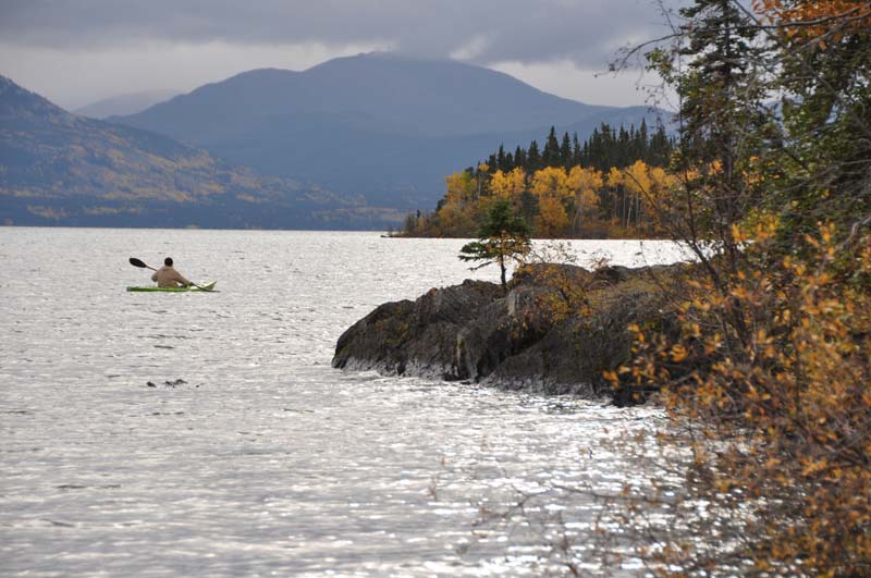
Our favorite place in the Yukon was Lake Laberge. We camped at Lake Laberge Territorial Campground ($12/night back in 2011) on the shore watching the Northern Lights at 2:00am and 23 degrees Fahrenheit.
We also kayaked on the lake, read The Cremation of Sam McGee, and savored the delicious cinnamon rolls from Tracie Harris’s Mom’s Bakery just outside the campground.
Our second favorite place in the Yukon was Whitehorse. The MacBride Museum with the First Nations Gallery, Sam McGee’s cabin, and many more exhibits.
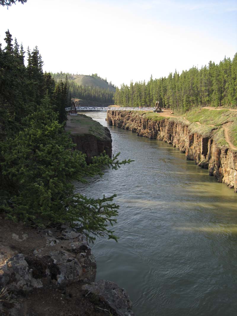
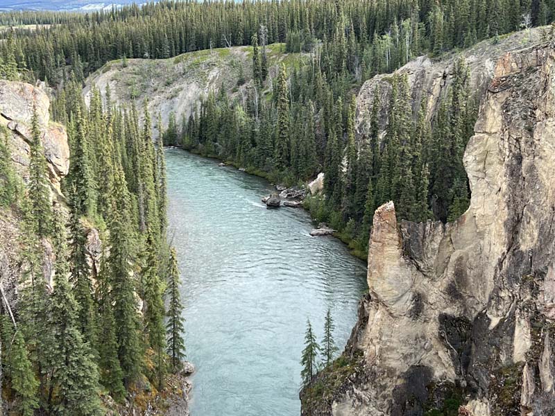
Hiking along Miles Canyon we were imagining what it was like rafting down the Yukon River through this narrow stretch.
Tracy Rivera
2016 Ford F350
2016 Northern Lite 8-11 SE
Yukon, Larger Than Life!
That is the logo and it truly represents Yukon. My wife and I have been traveling to the Yukon and around the territory for over 20 years and we can easily say we don’t have a favorite place because every day our camping spot is our current favorite place.
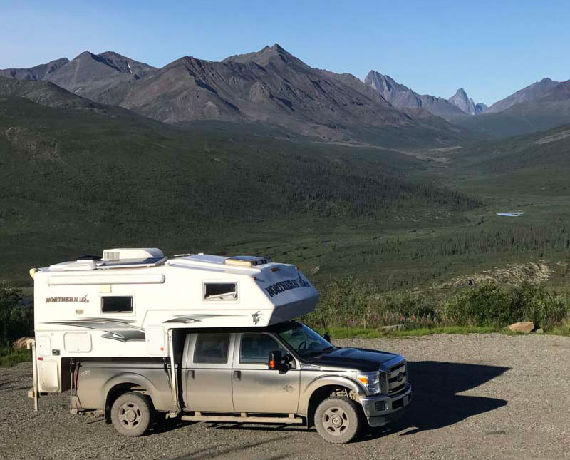
Above: Driving in the Yukon on the Dempster Highway
We love the wide open spaces, few people, and sheer beauty. This past summer our Yukon adventure took us up the Dempster Highway. Tombstone Territory Park should not be missed!
A great loop drive is from Skagway, Alaska to Dawson, Yukon. Then over the Top of the World Highway into Alaska. Then, drive to Chicken, Alaska, and then to Haines, Alaska.
Above: Campground in Tombstone Territorial Park
All government campgrounds are outstanding! They are clean and offer free firewood. We had a campfire every night.
Bruno Gauthier
2021 Ford F-350
2005 Adventurer 100WSB
A pleasant surprise was the small village of Carcross. We went there to go mountain biking. At the end of the day, we spent our afternoons at the beach on the edge of Lake Bennett (pictured below). The view was amazing.
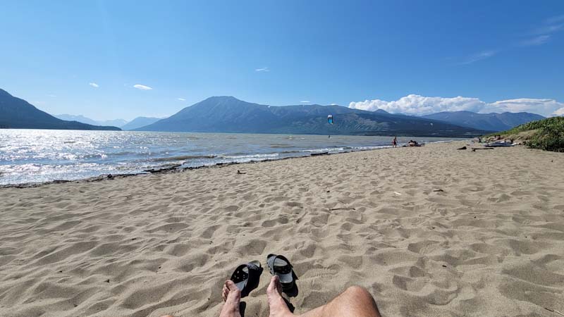
We stayed more days than planned because the Montana mountain offered us beautiful landscapes for cycling or hiking.
Above: Hero Mountain hiking trail
Stop at the tourist information center and you will find things to do according to your preferences.
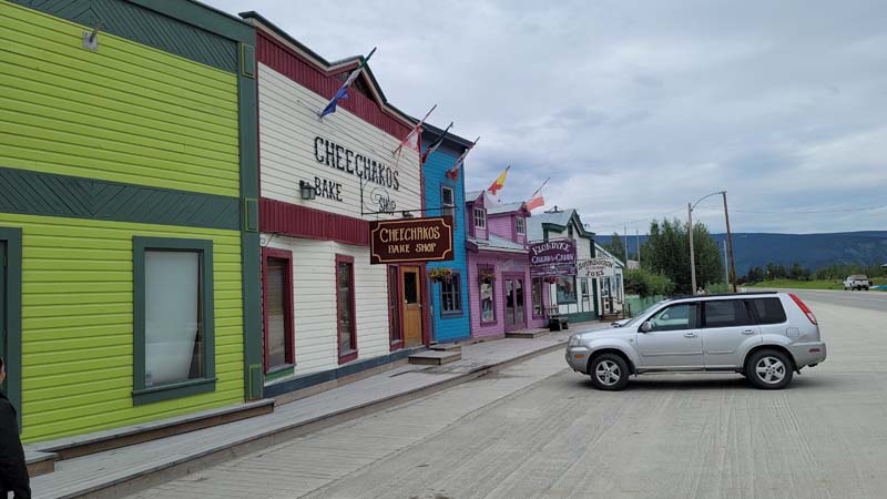
Above: Dawson City during the guided walking tour
Our second favorite was the visit to the village of Dawson. The guided tour gave us the chance to visit the interior of certain buildings which was worth the price of $8.50 per person. The tour was about 1 hour and 30 minutes.
The rest of the day we walked in town on wooden sidewalks and dirt streets. It was special because we could tell how the gold diggers lived at the time. Don’t be afraid to stop by the tourist information offices. They are happy to give you the details.
There is no shortage of places for dry camping. There are also a lot of government campgrounds at $20 a night without service.
Check out more travel articles in our Canada, Alaska, Lower 48 of the USA, and World sections.