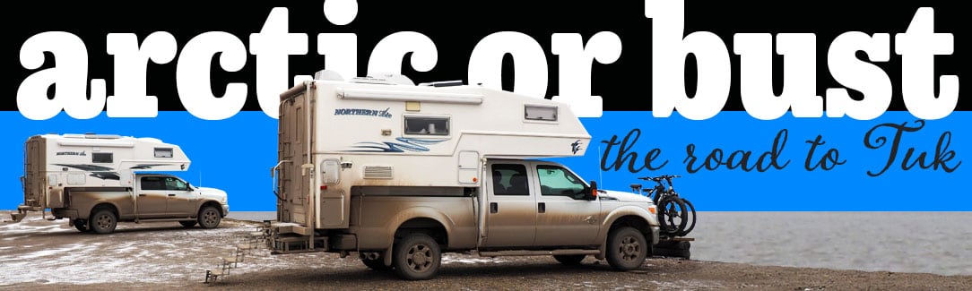
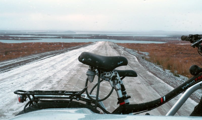
Nate Kew and Nancy Murray take their Northern Lite truck camper rig to the Arctic Ocean via the Inuvik-Tuktoyaktuk Highway. Don’t attempt this run without a spare or two, and gum boots. Not everyone makes it.
It’s hard to imagine that something as simple as building a road could be that challenging in modern times. After all, Romans were building roads in 300 BC for goodness sake. In an age when our cell phones can answer the question, “When did the Romans first build roads?”, building actual roads should be easy – right?
Not if you’re attempting to build on permafrost. Essentially frozen soil, permafrost freezes solid in the winter, melts in the spring, and can be nothing more than mud all summer. Evidently, building a road on permafrost is a bit like playing Jenga on a Klondike Bar during the dog days of August. That might sound challenging (and oddly delicious) but that tower is coming down.
Located on the Arctic Ocean in Canada’s Northwest Territories, Tuktoyaktuk (or Tuk) was only accessible by an ice road spanning frozen sections of the Mackenzie River delta and Arctic Ocean. After debating the feasibility of completing all-season road over permafrost for decades, Canada finally committed to the $65-million dollar project in 2012. Let the Jenga begin.
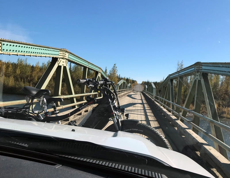
Starting in early 2014, crews from Inuvik and Tuk endured 24-hour shifts, arctic temperatures and punishing winds. Along the way they erected eight bridges and battled a myriad of ever-changing ground conditions. The road was finally opened to the public in November of 2017.
News of the Inuvik-Tuktoyaktuk Highway opening was exciting news for Nate and Nancy. They wanted to reach Tuk and meet its people before tourists permanently changed their way of life. With their Northern Lite 8-11 Special Edition and Ford F-350, they set out. What they didn’t know was just how bad the road conditions would be. Put your gum boots on now.
Tell us the story of how you decided to go to Tuk.
We decided to buy an RV in the spring of 2011. A truck camper was the best choice for us because of the ability to maneuver into tight spaces and navigate backcountry roads.
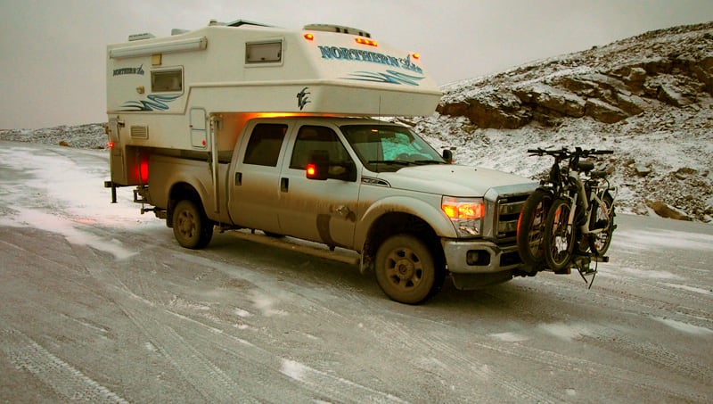
We bought a used 2009 Ford F-350 short box and a new 2011 Northern Lite 8-11 SE. We have since replaced the truck with a 2016 Ford F-350. The Northern Lite gives us the ability to load and unload with full tanks and also provided an interior style that we felt at home in.
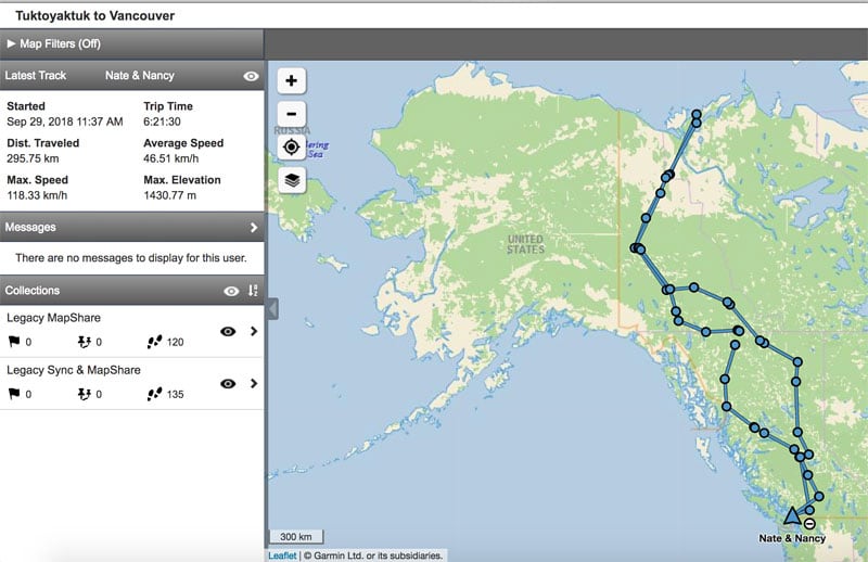
One of our goals was to drive to Tuktoyaktuk (Tuk) in Northwest Territories, Canada. A little over a year ago the last 130-kilometers of the Inuvik-Tuktoyaktuk Highway was pushed through to the town of Tuktoyaktuk. 2017 was the first year you could drive on a road to the Arctic Ocean in Canada.
The road crosses tundra and permafrost making it difficult to build an actual road. They had to bring in a lot of fill and lay it over the permafrost. A local guide from Tuk helped with the planning. He was familiar with the ground from his years of hunting and living off the land and knew where the firmest tundra was to support the road’s bed.
Before the road was completed, trucks from Dawson City would stockpile fuel in the fall. When the rivers froze over, an ice road would be employed. Before the new road, there were often several weeks when even the ice road was impassable.
On the new road, the gravel is soft. Fuel trucks are making big mud holes. There is no way to pave the road because the ground is too soft to support pavement. As a result, crews are continuously repacking and grading fill.
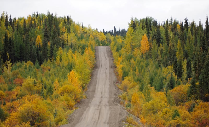
Above: At the start of the Dempster Highway, Yukon
What was the condition of the road when you took it?
From Dawson City to Tuk there is about 900-kilometers of dirt road. The condition of this part of the road is very poor in some areas. There were long stretches of mud holes that were rough, so we crawled along.
It took us three days to drive the 900-kilometers from Dawson City. The scenery is just gorgeous. You go through a couple different mountain ranges.
The first fuel stop is at Eagle Plains. There’s a gas station, motel and restaurant. The total population the town is nine. That’s about 380-kilometers from Dawson City. You can also stop in Ft. McPherson or Inuvik for fuel.
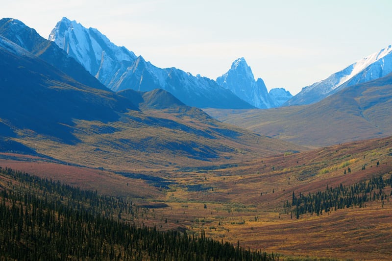
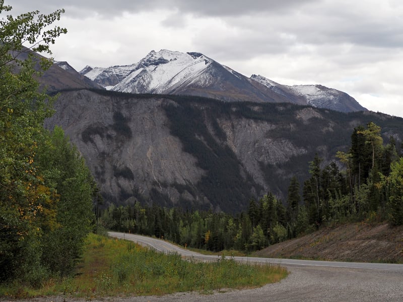
Above: The Ogilvie Mountains in Tombstone Park
There’s a territorial park about 70-miles from Dawson City called Tombstone. It has stunning mountain ranges. The road is actually quite good to Tombstone.
Beyond Tombstone, the road starts to get worse. We spoke to someone along the way who works at the information booth. He said that the area had received more rain that year than the 56 previous years. That obviously didn’t help the road conditions.
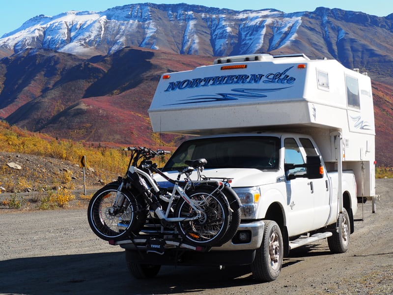
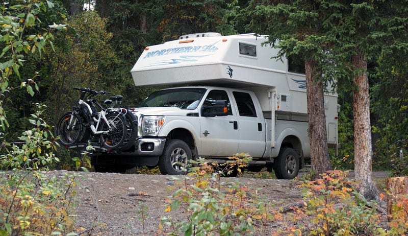
Above: Their Northern Lite in Tombstone Park
Could you just camp on the side of the road as you traveled?
Yes, you can pull over anywhere and camp. There are also some territorial campgrounds. We stayed in a couple campgrounds along the way.
It was all about the journey. I wanted to drive the road in the first year – before the tourist traffic changed the towns and villages too much.
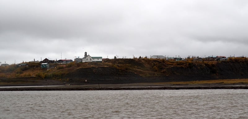
Tuk has a population of about 900-people. They had a lot of tourist traffic this year. The locals fully know that tourists are going to change their community.
Prior to the road, employment was a major problem in Tuk. A large Military radar station and an oil camp had closed. The tourist traffic should bring in some much needed income.
There are some enterprising souls who have started a restaurant. Another started a luncheon and a story telling business.
The people who started the restaurant thought they would sell hamburgers and hot dogs. They were surprised when the tourists wanted to eat local foods like Muk Tuk – whale blubber. They also serve local berries and wild game.
What is Tuk like as a town?
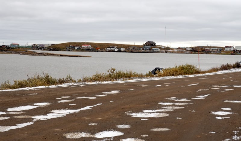
It reminded me of Newfoundland a bit. Tuk is a fishing village with a couple of good general stores. The houses are perched along the side of the ocean. There’s a huge abandoned oil camp that’s boarded up. The village has built a free campground with picnic tables, fire pits, and an enclosure.
The houses are fairly small because they are so expensive to heat. There are no trees, so wood heat is impractical. Fuel is trucked in and is quite expensive. There’s a tremendous amount of snowmobiles and ATVs.
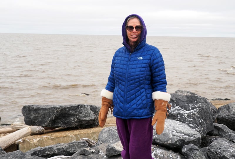
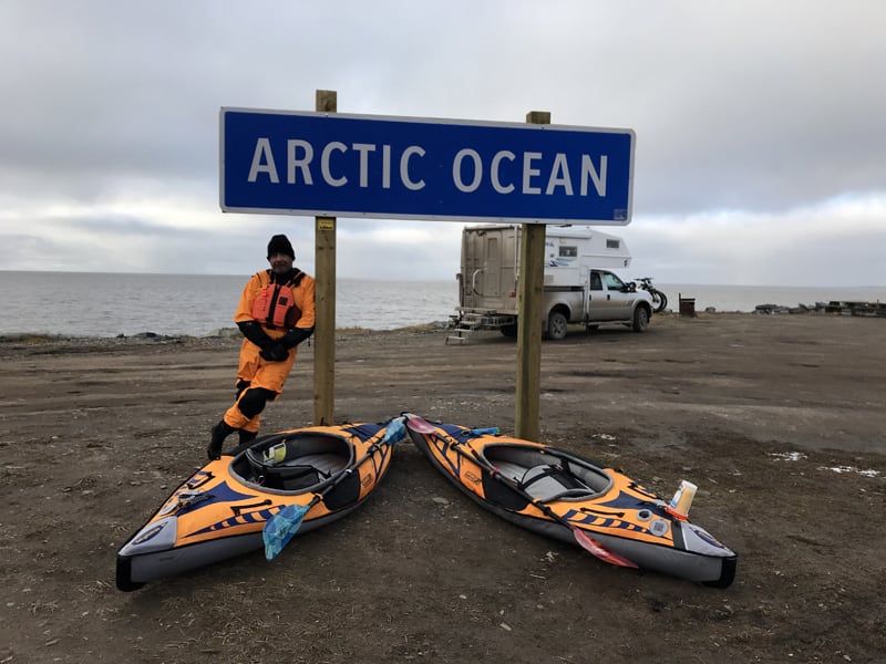
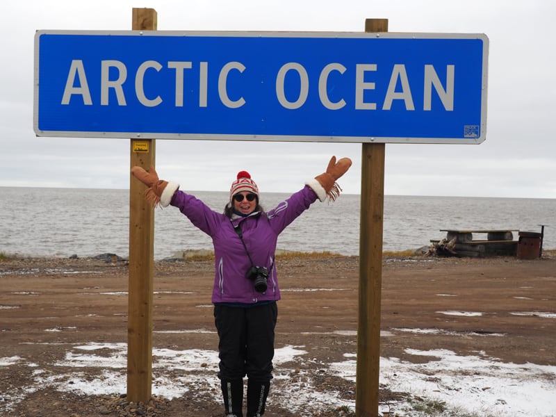
Above: Nancy next to the Arctic Ocean in Tuk
We were there on September 13th. Someone in the general store said that winter was already there to stay. It was -2 degrees Celsius (28 degrees Fahrenheit) during the day and -4 to -6 degrees Celsius at night (24 to 21 degrees Fahrenheit). The temperature doesn’t fluctuate much from day to night because the ocean keeps it constant.
The ground is so soft there that it’s hard to find anywhere to pull off the road to boondock. From Inuvik north you have to stick to the road or you could get stuck.
We were in Inuvik on September 11th and they had closed the municipal campground that morning. Inuvik has a lovely municipal campground with a dump, water, and electricity. Because it starts freezing so early, they close it down. We ended up getting water from the fire department.
That’s cold! Why did you choose to go there in September?
We like traveling in September because of the fall colors. The mosquitoes are gone. The campgrounds have a lot less traffic because the kids are back in school. And there is less tourist traffic.
Someone at one of the visitors centers told us Tombstone Park got 22,000 visitors last year and this year they got over 60,000. The opening of the road brought people from around the world to rent an RV and travel there.
ABove: The town of Tsiigehtchic at the Mackenzie River Crossing
I can’t imagine attempting the conditions you described in a rental RV.
A lot of people did wind up turning around because of the road conditions.
We lucked out because people earlier in the year were waiting for the Peel River and MacKenzie River ferry for several days because the landings were washed out.
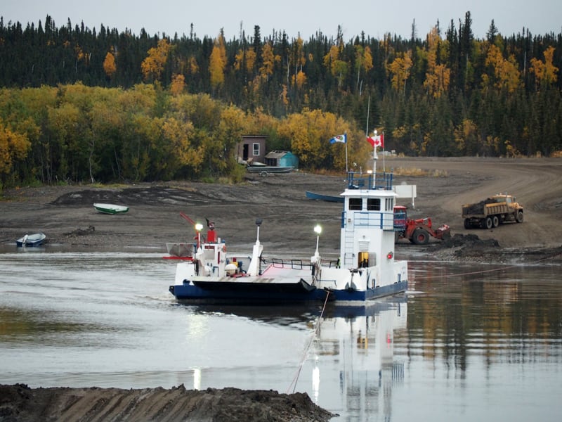
Above: The Peel River Ferry, note the muddy landings
When we were there, big front end loaders dropped fresh dirt on the muddy landings so we could put our truck in four-wheel drive and waddle onto the ferry.
Above: The view from Nancy’s kayak, Arctic Ocean
That sounds like an ordeal. Overall, was the 900-kilometer trip what you had hoped it would be? Was it worth it?
If you have an adventurous spirit, it is more than worth it. The scenery is gorgeous! It is an adventure just to get there.
We took our kayaks and paddled in the Arctic Ocean. There are islands and land masses further out so the waves get broken up a bit. It’s an amazing experience.
For most of the trip we were pretty much on our own. We might have seen a vehicle an hour or so. We went slow and steady without any problems.
When we were coming back, it was tough on the high mountain pass around the Northwest Territories and Yukon border. There was snow on the road. As we dropped in elevation the snow melted and the surface turned into slime.
Above: Crossing from the Northwest Territories into the Yukon
I put the truck in four-wheel drive and stayed on the crown of the road. It was very slippery. At one point we came up on an empty transport truck and he flagged us down. He told us that there was a loaded fuel truck coming and he was not going to move over for anyone. If he moved over he would slide into the ditch. We went behind him and waited for the truck to go through.
My brother-in-law went up there in his truck and was tent camping. He went a month before we went and it was quite rainy. He told us that there were lots of people in ditches who went off the road, especially in travel trailers.
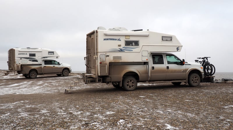
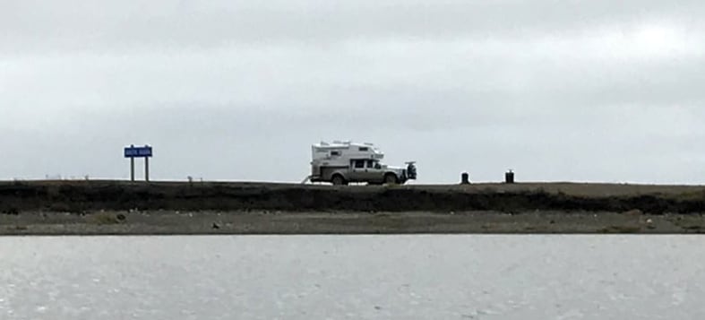
I saw in one of your pictures that another Northern Lite was up in Tuk. Was that planned?
He was actually there ahead of us. We had planned on camping in Inuvik, but the campground was closed. We did some shopping and left Inuvik at 7:00pm in evening.
It’s was only 130-kilometers, but it took us five-hours because the road was so bad. We pulled in at midnight to the campground. The fellow in the Northern Lite was there.
At the moment, the majority of people leave their trailer or camper in Inuvik and drive up for the day to Tuk. There are no services, so you’re dry camping.
Above: The Robert Campbell Highway
Where else did you go other than Tuk?
We took a lot of side trips. We went on a side road from Watson Lake that bypassed Whitehorse. It’s called the Robert Campbell Highway and it’s a dirt road that’s about 500-kilometers (372 miles). It’s just gorgeous and there’s not that much traffic.
Above: Dawson City, Yukon
We like to go on backroads and explore out of the way places. Dawson City is quite intriguing. It’s an old gold rush town. There’s lots to see and explore there.
Liard Hot Springs is a must see spot. If you’re traveling before September you need to make reservations at their provincial campground. The hot spring is in a natural setting with moss and trees. It’s open 24-hours a day. You can take a soak at 3:00am. If the Northern Lights are out, you can see them.
Above: The drive through Muncho Lake, British Columbia
Tumbler Ridge is also a nice place to go. There are about 30 different waterfalls and hiking trails. There is a short hike that’s only a couple kilometers. You’ll see dinosaur tracks in the rocks on the river bank. There are ATV trails and mountain bike trails. There’s a municipal campground with services. There are also provincial parks in the area. We were totally amazed by that place.
Above: Camping at Frances Lake, Yukon
What should others know before attempting the road to Tuk?
The road is much worse than I thought it would be. Make sure your spare tire is in good shape. We brought tire repair kits with us. We also have a really good electric tire pump. Luckily we didn’t need to use it. Some people had more than one flat.
If it happens to rain a lot while you’re up there you might find yourself camped out for two or three nights waiting for a ferry to cross a river. Or you may encounter a temporarily closed road while workers fix a bridge.
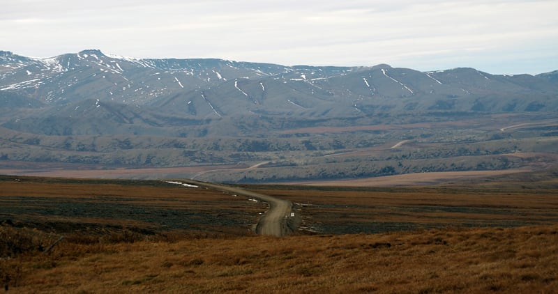
Above: The road through the Northwest Territories
We joined the Tuk page on Facebook. They post pictures weekly. That helped us see how muddy the area was before we arrived.
Gum boots were a top priority. Gum boots are a weatherproof boots with no laces. We lived in those during the trip.
You should allow for more time in the Northwest Territories and the Yukon. There is so much to see up there. We took a month to drive from Vancouver, British Columbia to Tuk and back. We could have taken two months to do the whole trip. The far north is spectacular.
Nate Kew and Nancy Murray’s Rig
Truck: 2016 Ford F350, crew cab, single rear wheel, four wheel drive
Camper: 2011 Northern Lite 8’11” Queen SE
Tie-Downs and Turnbuckles: Torklift Fastguns
Suspension: Three leaves added to the rear spring packs